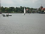
Mundon

Mundon is a village and civil parish on the Dengie peninsula in Maldon District in the county of Essex, England. It lies 3 miles south-east of Maldon. The manor of Munduna passed from the king's thegn Godwin to Eudo Dapifer at the Norman Conquest. The place-name 'Mundon' is first attested in the Domesday Book of 1086, where it appears as Munduna. The name means 'Munda's hill'.Until the Dissolution of the Monasteries Mundon formed part of the estates of St John's Abbey, Colchester; it passed to Thomas Cromwell before being returned to the Duchy of Lancaster, which held the right of presentation to the vicarage until the 20th century.The 14th-century timber-framed Church of St. Mary, built within the remains of the moat of Mundon Hall, and likely on Saxon and Norman foundations, has been disused since the 1970s, but is currently in the care of Friends of Friendless Churches, supported by English Heritage. Following a long period of remedial work, the church re-opened to visitors in August 2009. The entire church was underpinned, and much structural work was carried out by Bakers of Danbury. The church was re-glazed, and now, internally, appears lighter than it has in recent years. It is a grade I listed building.Mundon Hall is now represented by an 18th-century farmhouse of rendered and whitewashed brick.The village was struck by an F1/T2 tornado on 23 November 1981, as part of the record-breaking nationwide tornado outbreak on that day.
Excerpt from the Wikipedia article Mundon (License: CC BY-SA 3.0, Authors, Images).Mundon
Vicarage Lane, Essex
Geographical coordinates (GPS) Address Nearby Places Show on map
Geographical coordinates (GPS)
| Latitude | Longitude |
|---|---|
| N 51.689971 ° | E 0.709833 ° |
Address
Vicarage Lane
Vicarage Lane
CM9 6PA Essex, Mundon
England, United Kingdom
Open on Google Maps


