place

Heybridge Basin

Civil parishes in EssexMaldon DistrictVillages in Essex
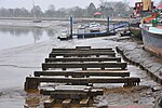
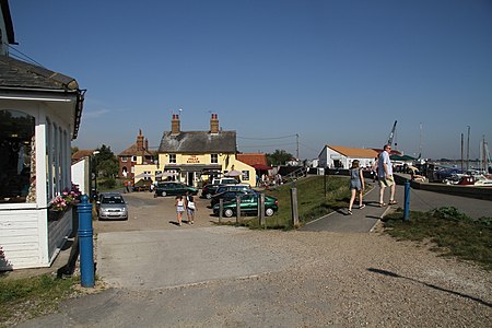
Heybridge Basin (6200973204)

Heybridge Basin is a village and civil parish about 1 mile from Maldon, in the Maldon district, in the county of Essex, England. In 2018 the built up area (which includes Osea Island) had an estimated population of 732. The parish was formerly part of Heybridge parish, on 1 April 2020 it became a separate parish. Heybridge Basin is where the Chelmer and Blackwater Navigation Canal merges into the tidal Blackwater Estuary, fed by the rivers Blackwater and Chelmer. The two rivers are joined by a lock which is regularly used by pleasure boats. The Basin was constructed in 1796. By 1799 there was a hamlet. Heybridge Basin was designated a conservation area on 21 January 1975. The conservation area has 8 grade II listed buildings.The Heybridge Basin area was struck by an F0/T1 tornado on 23 November 1981, as part of the record-breaking nationwide tornado outbreak on that day.

Excerpt from the Wikipedia article Heybridge Basin (License: CC BY-SA 3.0, Authors, Images).

Heybridge Basin
Basin Road, Essex

Geographical coordinates (GPS) Address Nearby Places
placeShow on map

Wikipedia: Heybridge BasinContinue reading on Wikipedia

Geographical coordinates (GPS)

Latitude Longitude
N 51.731224 ° E 0.70905657 °
placeShow on map

Address

Basin Road

Basin Road
CM9 4RN Essex, Heybridge Basin
England, United Kingdom
mapOpen on Google Maps

Heybridge Basin (6200973204)
Share experience

Nearby Places

Northey Island
Northey Island

Northey Island is an island in the estuary of the River Blackwater, Essex. It is linked to the south bank of the river by a causeway, covered for two hours either side of high tide. The island is approximately 1 mile (2 km) to the east of Maldon, Essex and 1 mile (2 km) to the west of Osea Island. The Battle of Maldon, 991 is believed to have taken place on the causeway and the south bank of the Blackwater near the island. At that time the causeway is thought to have been half as long as it is presently – 120 yards rather than 240 yards today.Significant land reclamation was carried out by the Dutch contractor Nicholas Van Cropenrough in the early 18th century; he enwalled marshland to significantly enlarge the island but the walls were breached by the sea and the land returned to marshland on 29 November 1897.In 1923 Northey was bought by the writer and campaigner Norman Angell; in 1933 he was awarded the Nobel Peace Prize.The whole island and part of the bank near the causeway are now a national nature reserve. Northey is home to diverse birdlife and this is reflected in the place name 'Awl Creek' which perpetuates the traditional Essex dialect word for the Avocet.At one time Northey was home to more species than it is now. The island was one of the last southern strongholds of the raven, the last bird being taken from the Ladies grove in 1888.It is uninhabited apart from the warden. The island is owned by the National Trust and can be visited by arrangement with the warden. It is one of 43 (unbridged) tidal islands which can be walked to from the British mainland and one of six such tidal islands in Essex.