place

Colgrain

Argyll and Bute geography stubsVillages in Argyll and Bute

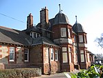
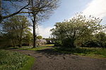
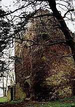
Colgrain is a village in Argyll and Bute, Scotland, located to the east of Helensburgh.The name Colgrain is known from at least 1377 when Sir William Denzeltoun (of Colgrane) gives his consent to a grant made by his father, Sir John Denzeltoun of that Ilk, to the church of Glasgow.

Excerpt from the Wikipedia article Colgrain (License: CC BY-SA 3.0, Authors).

Geographical coordinates (GPS)

Latitude Longitude
N 55.985 ° E -4.686 °
placeShow on map

Address


G82 5HG
Scotland, United Kingdom
mapOpen on Google Maps

Share experience

Nearby Places

Geilston Garden
Geilston Garden

Geilston Garden is a property of the National Trust for Scotland, north-west of Cardross, Argyll and Bute. Geilston Garden was developed more than two hundred years ago with a date given for its development being 1797, combining several features (traditional walled garden, kitchen garden, wooded area). The walled garden has a dominating 100-foot Wellingtonia (Sequoiadendron giganteum) in the centre of the lawn. The Geilston burn wends its way through the north of the estate towards the River Clyde in Cardross. The origins of the garden were most likely a result of the 1770 Montgomery Act, which saw the land around the house enclosed and planting undertaken.Geilston was opened to the public with the death of the last resident, Margaret Bell, who was a friend of Elizabeth Hendry, the owner of Geilston who bequeathed the house to the National trust for Scotland and gave her friend life rent of the house. The Hendrys moved into Geilston as tenants but the family bought the house from the Geils in 1922. The garden as it appears today was mostly laid out by Elizabeth Hendry and Margaret Bell. A cannon within the garden is said to have been a trophy from the Battle of Corunna brought to the Garden by Major General Geils, a previous owner of Geilston.The kitchen garden is the most labour-intensive area. It springs to life in April with the first sowings of carrots, parsnips and beetroot closely followed by transplanted brassicas. Visitors can buy in-season produce from a small stand at the garden's entrance. The walled garden is the focus of spring colour with azaleas, heathers and unusual shrubs such as Cornus kousa 'Satomi'. Summer colour is provided by the spectacularly vigorous species in the long herbaceous border – Thalictrum, Filipendula, Eupatorium, Helenium, Phlox and Sidalcea dominate the display. The garden is open from April to October daily. The adjacent Geilston House is not open to the public.

Cardross
Cardross

Cardross (Scottish Gaelic: Càrdainn Ros) is a large village with a population of 2,194 (2011) in Scotland, on the north side of the Firth of Clyde, situated halfway between Dumbarton and Helensburgh. Cardross is in the historic geographical county of Dunbartonshire but the modern political local authority of Argyll and Bute. Cardross Village took its name from the historic parish in which it is located and where King Robert the Bruce lived the final years of his life. The Parish of Cardross stretched in area from the River Leven on the west side of Dumbarton to Camus Eskan (near Helensburgh), and stretched as far north to include the village of Renton in the Vale of Leven. The distinction between Cardross village and Cardross Parish is particularly important for students of Scottish history. King Robert the Bruce's documented association with ’Cardross’ occurred three centuries prior to the existence of the modern-day village, and at a time when the name referred to the ecclesiastical parish and its church, Cardross Kirk. The original piece of land known as ’Cardross’ is at the eastern edge of the historic parish and the western point of the confluence of the River Clyde and River Leven at the town of Dumbarton, facing across to Dumbarton Rock and Castle. Today the land is known as “sand point” and sits on the edge of Dumbarton's Levengrove Park. The site of medieval Cardross Kirk, and its remains, sits within Levengrove Park.