Craigendoran
Argyll and Bute geography stubsGeography of Argyll and Bute

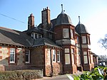
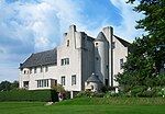
Craigendoran (Gaelic: Creag an Dòbhrain) is a suburb at the eastern end of Helensburgh in Scotland, on the northern shore of the Firth of Clyde. The name is from the Gaelic for "the rock of the otter". It is served by Craigendoran railway station. Craigendoran pier was next to the station, with the railway connecting with Clyde steamers. This pier has since closed and fallen into disrepair. Hermitage Academy is on the eastern outskirts of Craigendoran.
Excerpt from the Wikipedia article Craigendoran (License: CC BY-SA 3.0, Authors, Images).Craigendoran
Campbell Drive,
Geographical coordinates (GPS) Address Nearby Places Show on map
Geographical coordinates (GPS)
| Latitude | Longitude |
|---|---|
| N 55.997 ° | E -4.708 ° |
Address
Campbell Drive
Campbell Drive
G84 7JS , Craigendoran
Scotland, United Kingdom
Open on Google Maps


