Cardross

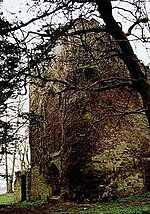
Cardross (Scottish Gaelic: Càrdainn Ros) is a large village with a population of 2,194 (2011) in Scotland, on the north side of the Firth of Clyde, situated halfway between Dumbarton and Helensburgh. Cardross is in the historic geographical county of Dunbartonshire but the modern political local authority of Argyll and Bute. Cardross Village took its name from the historic parish in which it is located and where King Robert the Bruce lived the final years of his life. The Parish of Cardross stretched in area from the River Leven on the west side of Dumbarton to Camus Eskan (near Helensburgh), and stretched as far north to include the village of Renton in the Vale of Leven. The distinction between Cardross village and Cardross Parish is particularly important for students of Scottish history. King Robert the Bruce's documented association with ’Cardross’ occurred three centuries prior to the existence of the modern-day village, and at a time when the name referred to the ecclesiastical parish and its church, Cardross Kirk. The original piece of land known as ’Cardross’ is at the eastern edge of the historic parish and the western point of the confluence of the River Clyde and River Leven at the town of Dumbarton, facing across to Dumbarton Rock and Castle. Today the land is known as “sand point” and sits on the edge of Dumbarton's Levengrove Park. The site of medieval Cardross Kirk, and its remains, sits within Levengrove Park.
Excerpt from the Wikipedia article Cardross (License: CC BY-SA 3.0, Authors, Images).Cardross
Station Road,
Geographical coordinates (GPS) Address Nearby Places Show on map
Geographical coordinates (GPS)
| Latitude | Longitude |
|---|---|
| N 55.9625 ° | E -4.6527777777778 ° |
Address
Station Road
Station Road
G82 5PX
Scotland, United Kingdom
Open on Google Maps


