place

Mission Nuestra Señora de la Soledad

1791 establishments in Alta California1791 in Alta CaliforniaCalifornia Historical LandmarksChurches in Monterey County, CaliforniaHistory museums in California
History of Monterey County, CaliforniaMuseums in Monterey County, CaliforniaReligious museums in CaliforniaReligious organizations established in 1791Roman Catholic Diocese of Monterey in CaliforniaSalinas ValleySpanish missions in CaliforniaTourist attractions in Monterey County, California
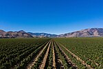
Mission Soledad, 36641 Fort Romie, Rd Soledad, CA USA panoramio (2)

Mission Nuestra Señora de la Soledad (Spanish: Misión Nuestra Señora de la Soledad), commonly known as Mission Soledad, is a Spanish mission located in Soledad, California. The mission was founded by the Franciscan order on October 9, 1791, to convert the Native Americans living in the area to Catholicism. It was the thirteenth of California's Spanish missions, and is named for Mary, Our Lady of Solitude. The town of Soledad is named for the mission. After the 1835 secularization of the mission and the later sale of building materials, the mission fell into a state of disrepair and soon after was left in ruins. A restoration project began in 1954 and a new chapel was dedicated in 1955. The chapel now functions as a chapel of Our Lady of Solitude, a parish church of the Diocese of Monterey. The priests' residence was later recreated, and functions as a museum.

Excerpt from the Wikipedia article Mission Nuestra Señora de la Soledad (License: CC BY-SA 3.0, Authors, Images).

Mission Nuestra Señora de la Soledad
Fort Romie Road, Soledad

Geographical coordinates (GPS) Address Phone number Website Nearby Places
placeShow on map

Wikipedia: Mission Nuestra Señora de la SoledadContinue reading on Wikipedia

Geographical coordinates (GPS)

Latitude Longitude
N 36.404618833333 ° E -121.35580683333 °
placeShow on map

Address

Iglesia de Nuestra Señora de la Soledad

Fort Romie Road 36641
93960 Soledad
California, United States
mapOpen on Google Maps

Phone number

call+18316782586

Website
missionsoledad.com

linkVisit website

Mission Soledad, 36641 Fort Romie, Rd Soledad, CA USA panoramio (2)
Share experience

Nearby Places

Monterey County wine

Monterey County wine is a appellation that designates wine made from grapes grown in Monterey County, California which lies entirely within the expansive multi-county Central Coast viticultural area. County names in the United States automatically qualify as legal appellations of origin for wine produced from grapes grown in that county and do not require registration with the Alcohol and Tobacco Tax and Trade Bureau (TTB). TTB was created in January 2003, when the Bureau of Alcohol, Tobacco and Firearms, or ATF, was extensively reorganized under the provisions of the Homeland Security Act of 2002.Monterey County is renowned internationally for its scenic splendor with the California Coast Ranges forming the mountainous shoreline and wind-swept evergreens on coastal cliffs outlined by the cinematic Pacific Coast Highway (PCH) along Big Sur, the white-sanded beaches in Carmel, the quiet tide pools at Pebble Beach and fertile soils of the Salinas Valley caressed by the maritime California weather. These elements provide ideal terrain, climate, and soil creating unique microclimates throughout the county for a vibrant viticulture economy. This historic region is one of the popular bastions of cool-climate viticulture because of its proximity to the Pacific coast. The majority of Monterey's cultivated 69,000 acres (27,923 ha) resides in the 80 miles (129 km) elongated, fertile Salinas Valley framed by the central inner Coastal Range, continuously defined on a southeast to northwest axis by the Santa Lucia Range to the west and the Gabilan Range along its eastern boundary. As of 2024, the county is resident to ten established American Viticultural Areas (AVA), each with distinct viticultural personalities. They are Chalone, Arroyo Seco, San Lucas, Santa Lucia Highlands, San Bernabe, Hames Valley, Carmel Valley, San Antonio Valley, Gabilan Mountains and the large Monterey viticultural areas.

Santa Lucia Highlands AVA

Santa Lucia Highlands is an American Viticultural Area (AVA) located in central Monterey County, California and lies within the boundaries of the larger, elongated Monterey viticultural area. It was recognized by the Bureau of Alcohol, Tobacco and Firearms {ATF}, Treasury on June 15, 1992 after reviewing the petition from Mr. Barry Jackson of the Harmony Wine Company proposing a viticultural area to be known as "Santa Lucia Highlands." The area consists of the eastern flank of the Santa Lucia Mountain Range and is located completely within the boundaries of the established Monterey viticultural area. The general boundaries are: Limekiln Creek to the north; the Salinas River and its associated terraces to the east; the western border of the Arroyo Seco viticultural area in the southeast; and the western border of the Monterey viticultural area to the west. Inititially, the total area of the appellation was approximately 22,000 acres (34 sq mi) with 1,850 acres (749 ha) committed to active viticulture, with plans to cultivate an additional 400 acres (162 ha). Winegrowing in the region dates back to the late 18th Century, when Spanish missionaries planted the first vines. The modern wine industry sprang up in the 1970s. Some of the vineyards lie as high as 1,200 feet (366 m) above sea level, with about half of them planted to the Pinot noir grape. The region enjoys cool morning fog and breezes from Monterey Bay followed by warm afternoons thanks to direct southern exposures to the sun. In 2021, the Alcohol and Tobacco Tax and Trade Bureau (TTB), Treasury ruled on a modification of the shared Santa Lucia Highlands-Arroyo Seco AVA boundary. The modification removed 376 acres (1 sq mi) from the Santa Lucia Highlands viticultural area, and moved 148 acres (0 sq mi) from the Arroyo Seco viticultural area placing it entirely within the Santa Lucia Highlands. The modification reduced the size of the AVA by less than 1 percent and did not have any impact on the boundaries of the Monterey AVA or the Central Coast.