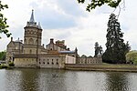
West Horsley
Borough of GuildfordCivil parishes in SurreyCricket in SurreyEnglish cricket in the 14th to 17th centuriesEngvarB from July 2016 ... and 1 more
Villages in Surrey

West Horsley is a semi-rural village between Guildford and Leatherhead in Surrey, England. It lies on the A246, and south of the M25 and the A3. Its civil parish ascends to an ancient woodland Sheepleas Woods which are on the northern downslopes of the ridge of hills known as the North Downs in the extreme south of the village, and cover about a tenth of its area, 255 acres (1 km2). The bulk of West Horsley's land is north of the Surrey Hills AONB, the rest is within it.
Excerpt from the Wikipedia article West Horsley (License: CC BY-SA 3.0, Authors, Images).West Horsley
Braeside Close,
Geographical coordinates (GPS) Address Nearby Places Show on map
Geographical coordinates (GPS)
| Latitude | Longitude |
|---|---|
| N 51.261 ° | E -0.454 ° |
Address
Cranmore School
Braeside Close
KT24 6AT , West Horsley
England, United Kingdom
Open on Google Maps


