Vale of Mowbray

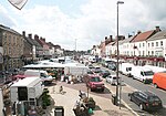
The Vale of Mowbray is a plain in North Yorkshire, England. It is bounded by the Tees lowlands to the north, the North York Moors and the Hambleton Hills to the east, the Vale of York to the south, and the Yorkshire Dales to the west. Northallerton, Catterick Garrison, and Thirsk are the largest settlements within the area. The Vale of Mowbray is distinguishable from the Vale of York by its meandering rivers and more undulating landscape. The vale is the floodplain of the River Swale and its tributaries, including the Wiske and Cod Beck. The river enters the vale from Swaledale, in the north-west, then flows in a south-easterly direction before entering the Vale of York. The underlying geology of the landscape is sandstone and mudstone, with clays and silts in the south-west. The region is agricultural, with a mix of arable and grassland, though isolated pockets of woodland remain. The fields are medium-sized and typically bounded by hawthorn hedges. The villages are often linear, following the major through road, and the houses are generally brick built with pantile roofs. The vale is a major north-south transport corridor, containing the A1 road and the East Coast Main Line, which are respectively the main road and rail links between London and Edinburgh.
Excerpt from the Wikipedia article Vale of Mowbray (License: CC BY-SA 3.0, Authors, Images).Vale of Mowbray
High Street,
Geographical coordinates (GPS) Address Website Nearby Places Show on map
Geographical coordinates (GPS)
| Latitude | Longitude |
|---|---|
| N 54.342 ° | E -1.435 ° |
Address
The Northallerton Inn
High Street 72
DL7 8ES
England, United Kingdom
Open on Google Maps


