Allertonshire

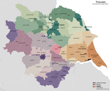
Allertonshire or Allerton was a wapentake and liberty in the North Riding of Yorkshire, England. Northallerton, current name of Allerton, was historically associated with the Bishopric of Durham, being an ecclesiastical peculiar and exclave until the 19th century. The shire's central location in the North Riding (1889-1974) and its successor North Yorkshire (1974–present) allowed the town to become the administrative centre for both counties. The contiguous part of the wapentake included the ancient parishes of: Birkby Kirby Sigston Leake Northallerton Osmotherley North Otterington Thornton-le-Street The wapentake also included exclaves of: the extra parochial area of Hutton Conyers the parish of West Rounton the parish of Sessay the Yorkshire part of the parish of Sockburn (townships of Girsby and Over Dinsdale) The wapentake also included part of the parish of Kirklington, including the vill of Howgrave.
Excerpt from the Wikipedia article Allertonshire (License: CC BY-SA 3.0, Authors, Images).Allertonshire
Crosby Gardens,
Geographical coordinates (GPS) Address Nearby Places Show on map
Geographical coordinates (GPS)
| Latitude | Longitude |
|---|---|
| N 54.338 ° | E -1.429 ° |
Address
Crosby Gardens
DL6 1AR
England, United Kingdom
Open on Google Maps


