place

Humber Bay

Bays of OntarioLandforms of TorontoToronto geography stubs
HumberBay
HumberBay

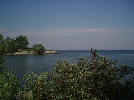
Humber Bay is a bay of Lake Ontario south of Toronto, Ontario, Canada. It is located between Ontario Place on the east and Mimico Creek to the west. The bay gives its name to Etobicoke's Humber Bay neighbourhood.

Excerpt from the Wikipedia article Humber Bay (License: CC BY-SA 3.0, Authors, Images).

Geographical coordinates (GPS)

Latitude Longitude
N 43.626 ° E -79.457 °
placeShow on map

Address

Golden Horseshoe


Ontario, Canada
mapOpen on Google Maps

HumberBay
HumberBay
Share experience

Nearby Places

Sunnyside, Toronto
Sunnyside, Toronto

Sunnyside is a lakefront district in Toronto, Ontario, Canada. It includes a beach and park area along Lake Ontario's Humber Bay, from west of Exhibition Place to the mouth of the Humber River. The area has several recreation uses, including rowing clubs, sports clubs, picnic areas, playgrounds, a nightclub, a bathing pavilion and public pool. The area is a 3 kilometres (1.9 mi) long strip along the lakeshore, bounded by the Gardiner Expressway and rail lines, which separate it from the Parkdale, Roncesvalles and Swansea neighbourhoods to the north. The name originates in a local farm owned by John Howard, which was situated just to the north, on the location of the current St. Joseph's Health Centre hospital. The area is first noted in Toronto history as the location of the landing of an 1813 attack in the War of 1812. As Toronto grew, High Park preserved the open space to the north, while the Sunnyside area along the lake was taken over by new rail lines and a hydro-electric line serving Toronto, although the area remained popular for boating and swimming. By 1900, there were calls to clean up the area and in the 1910s, the area was the site of a massive waterfront reclamation public works project which expanding the land area by 38 hectares (94 acres), provided a breakwater for boating and built several beaches. Its popularity grew as a summertime recreation area and from 1922 to 1955, the reclaimed land was home to the popular Sunnyside Amusement Park which ran every summer. The amusement park was demolished to facilitate the building of the expressway, leaving behind several shoreline recreation uses from the era of the park, including the pool, the beaches and the sports clubs, all of which remain popular and well-used each summer.
Queen Elizabeth Way Monument

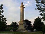
The Queen Elizabeth Way Monument, also known as the Lion Monument and as the Loring Lion, is an Art Deco monument located in Toronto, Ontario, Canada. The 1939–1940 monument honouring Queen Elizabeth was built as a decorative marker monument for the Toronto entrance to the Queen Elizabeth Way (QEW) highway. The stone monument consists of a column with a crown at the top on top of a base. On the face of the base section is a profile of the Queen and a stone lion is placed in front of the base. The monument was designed by architect William Lyon Somerville, who also designed the Henley Bridge of the QEW. Sculptor Frances Loring was commissioned to execute the stone lion. Florence Wyle modelled the royal profiles and crown. Loring started the lion after the entry of Britain and Canada into World War II and it inspired her design: "a snarling, defiant British Lion, eight feet high." Loring personally carved the lion herself from Queenston limestone. She fired her originally commissioned carver after he made unauthorized changes and took over the carving herself in the late summer and fall of 1940. The monument cost CA$23,000 ($393,875 in 2020 dollars)In 1972, the Government of Ontario announced a new expansion to eight lanes of the QEW at the Humber River, necessitating the removal of the monument. It was first proposed to be moved to Ontario Place but the proposed location spawned public criticism. Instead, the monument was moved in August 1975 to nearby Sir Casimir Gzowski Park along Lake Ontario, on the east side of the Humber River. It was re-dedicated in 1989 by Queen Elizabeth, by then styled and known as The Queen Mother. The Queen Elizabeth Way was Ontario's first "super-highway" and it was adorned with decoration, such as its light standards and the Henley Bridge in St. Catharines, Ontario. The bridge is adorned with monuments at each end of the bridge in the area between the two directions of traffic. Each is a galley prow with four regal lions in the boat, each bearing a unique shield. There are also piers at each end, two decorated with sailing ships, a third of a native person and canoe and a fourth of a rower. These were designed by the same team that designed the Lion Monument. These remain in their original location.

Fort Toronto
Fort Toronto

Fort Toronto, also known as Fort Portneuf, was a French trading post that was located near the mouth of the Humber River in what is now Toronto, Ontario, Canada. It was constructed in 1750 by French military officer Pierre Robineau de Portneuf, who had been instructed to build it in order to facilitate trade with First Nations in the Pays d'en Haut region of New France.Fort Toronto was the second French trading post established in the Humber River area. The first one (known as Magasin Royal or Fort Douville) had been built in 1720 by order of the Governor General of New France at that time (Philippe de Rigaud, Marquis de Vaudreuil) near today's Baby Point, about 2 kilometres (1.2 mi) north of the mouth of the Humber River (then known as the Tanaovate River). The French abandoned Magasin Royal by the end of the 1720s, and they did not establish another trading post in the area until the construction of Fort Toronto. Fort Toronto's immediate success in attracting First Nations traders led to the establishment of nearby Fort Rouillé in the following year. These forts existed mainly to facilitate trade between the French and the indigenous peoples. During the Seven Years' War, both forts were abandoned by the French, with Fort Rouillé being razed to prevent its capture by the advancing British forces. Following the war, Fort Toronto was renovated and repurposed as a fur trading post by Jean-Bonaventure Rousseau, after Great Britain captured Quebec City and the entire French colony of New France.