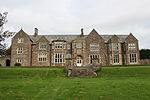
Stanton Drew

Stanton Drew is a small village and civil parish within the Chew Valley in Somerset, England, lying north of the Mendip Hills, 8 miles (13 km) south of Bristol in the area of the Bath and North East Somerset unitary authority. Just outside the village are the prehistoric Stanton Drew stone circles. The largest of these, the Great Circle, is a henge monument and the second largest stone circle in Britain, after Avebury. The circle is 113 m in diameter and probably consisted of 30 stones, of which 27 survive today. The village has a range of listed buildings, dating from the 13th to 15th centuries, including the church of St Mary the Virgin, the Round House (Old Toll House) and several farmhouses. The parish of Stanton Drew, which includes the hamlet of Stanton Wick, had a population of 787 in 2011. Until 1947 the parish also included Belluton and part of Pensford. It has a primary school, pubs (the Druids Arms and the Carpenters Arms at Stanton Wick), a church and a village hall, which is the venue for various village activities. The area around the village has several dairy and arable farms on neutral to acid red loamy soils with slowly permeable subsoils. It is also a dormitory village for people working in Bath and Bristol.
Excerpt from the Wikipedia article Stanton Drew (License: CC BY-SA 3.0, Authors, Images).Stanton Drew
Geographical coordinates (GPS) Address Nearby Places Show on map
Geographical coordinates (GPS)
| Latitude | Longitude |
|---|---|
| N 51.3663 ° | E -2.5782 ° |
Address
BS39 4EP
England, United Kingdom
Open on Google Maps


