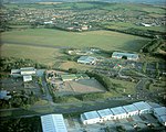
Maes Knoll
Archaeological sites in SomersetBath and North East SomersetEngvarB from September 2013Hill forts in SomersetHistory of Somerset ... and 3 more
Iron Age sites in EnglandNeolithic settlementsScheduled monuments in Bath and North East Somerset

Maes Knoll (sometimes Maes tump or Maes Knoll tump) is an Iron Age hill fort in Somerset, England, located at the eastern end of the Dundry Down ridge, south of the city of Bristol and north of the village of Norton Malreward near the eastern side of Dundry Hill. It is a Scheduled Ancient Monument.
Excerpt from the Wikipedia article Maes Knoll (License: CC BY-SA 3.0, Authors, Images).Maes Knoll
Maesknoll Lane,
Geographical coordinates (GPS) Address External links Nearby Places Show on map
Geographical coordinates (GPS)
| Latitude | Longitude |
|---|---|
| N 51.392072222222 ° | E -2.5755611111111 ° |
Address
Maes Knoll
Maesknoll Lane
BS39 4EY
England, United Kingdom
Open on Google Maps


