place

Hucknall Town F.C.

1943 establishments in EnglandAssociation football clubs established in 1943Central Midlands Football LeagueEast Midlands Counties Football LeagueEast Midlands Regional League
EngvarB from April 2018Football clubs in EnglandHucknall Town F.C.Mining association football teams in EnglandNational League (English football)Northern Counties East Football LeagueNorthern Premier League clubsUnited Counties League
Hucknall Town
Hucknall Town

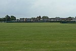
Hucknall Town Football Club are a football club based in the town of Hucknall, Nottinghamshire, England. The club are members of the United Counties League Division One and play at Watnall Road.

Excerpt from the Wikipedia article Hucknall Town F.C. (License: CC BY-SA 3.0, Authors, Images).

Hucknall Town F.C.
Watnall Road, Ashfield District Hucknall

Geographical coordinates (GPS) Address External links Nearby Places
placeShow on map

Wikipedia: Hucknall Town F.C.Continue reading on Wikipedia

Geographical coordinates (GPS)

Latitude Longitude
N 53.028644444444 ° E -1.2174111111111 °
placeShow on map

Address

Hucknall Town Football Club

Watnall Road
NG15 6EY Ashfield District, Hucknall
England, United Kingdom
mapOpen on Google Maps

linkWikiData (Q18475)
linkOpenStreetMap (357283360)

Hucknall Town
Hucknall Town
Share experience

Nearby Places

Hucknall
Hucknall

Hucknall, formerly Hucknall Torkard, is a market town in the Ashfield district of Nottinghamshire, England. It lies 7 miles north of Nottingham, 7 miles south-east of Kirkby-in-Ashfield, 9 miles from Mansfield and 10 miles south of Sutton-in-Ashfield. It is the second largest town in the Ashfield district after Sutton-in-Ashfield. Hucknall is 7 miles (11 km) north-west of Nottingham, on the west bank of the Leen Valley, on land which rises from the Trent Valley in the south and extends northwards to Kirkby-in-Ashfield. The Whyburn or Town Brook flows through the town centre. Farleys Brook marks its southern boundary. Due to the mass amount of housing and industrial estates along the southside of the town. Hucknall is contiguous with the wider City of Nottingham with the suburbs of Bulwell and Bestwood Village both to the south and southeast. The town's highest point is Long Hill, at 460 ft (140 m) above sea level, with views over the city and Trent Valley, which descends to 22–24 metres (72–79 ft) AOD, flowing just beyond most of the city centre.The town is surrounded by farmland or parkland. To the north-west lie Misk Hills and Annesley. To the north-east of the town are the villages of Linby and Papplewick, and beyond these two, Newstead Abbey and its grounds, once the residence of Lord Byron. To the west lies Eastwood, birthplace of D. H. Lawrence and an inspiration for many of his novels and short stories. To the east of the town is Bestwood Country Park. The contiguous settlements of Butler's Hill and Westville often appear as distinct entities on maps, but are generally seen as parts of Hucknall. They belong to its historic and present-day Church of England parish, although the town itself has no civil parish council. The identity is reinforced by being part of the post town and by being shared wards of Hucknall.