place

Astoria Park

1936 establishments in New York CityAstoria, QueensBuildings and structures completed in 1936New York City Designated Landmarks in Queens, New YorkParks in Queens, New York
Robert Moses projectsSkateparks in New York CitySkateparks in the United StatesUrban public parksUse mdy dates from January 2021Works Progress Administration in New York City
Astoria Park jeh
Astoria Park jeh

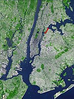
Astoria Park is a 59.96-acre (24.26 ha) public park in the Astoria neighborhood of Queens in New York City. The park is situated on the eastern shore of the Hell Gate, a strait of the East River, between Ditmars Boulevard to the north and Hoyt Avenue to the south. The Robert F. Kennedy (Triborough) and Hell Gate Bridges respectively pass over the park's southern and northern sections. Astoria Park contains a playground, a soccer field, a running track, a skate park, and courts for tennis, basketball, and bocce. Astoria Park also includes the Astoria Play Center, which consists of a recreation center and a pool. The park and play center are maintained by the New York City Department of Parks and Recreation (NYC Parks). While Astoria Park was planned in 1905, the land was not acquired until October 1913. Astoria Park was formally named after the surrounding neighborhood in December 1913 and recreational facilities gradually opened within the park over the two following decades. The pool and bathhouse were designed by John Hatton during a Works Progress Administration project in 1935–1936 and was used for the United States Olympic Trials for swimming during 1936, 1952, and 1964. The park was extensively renovated in the 1980s and the late 2010s. The Astoria Play Center was designated a city landmark by the New York City Landmarks Preservation Commission in 2007.

Excerpt from the Wikipedia article Astoria Park (License: CC BY-SA 3.0, Authors, Images).

Astoria Park
Shore Boulevard, New York Queens

Geographical coordinates (GPS) Address Nearby Places
placeShow on map

Wikipedia: Astoria ParkContinue reading on Wikipedia

Geographical coordinates (GPS)

Latitude Longitude
N 40.779444444444 ° E -73.921944444444 °
placeShow on map

Address

Astoria Play Center and Swimming Pool

Shore Boulevard
11102 New York, Queens
New York, United States
mapOpen on Google Maps

Astoria Park jeh
Astoria Park jeh
Share experience

Nearby Places

Removal of Hell Gate rocks

The removal of obstructive rocks from Hell Gate, a narrow tidal strait in New York City's East River and a major water transportation route, began in 1849, when French engineer Benjamin Maillefert, cleared some of the rocks. Then in 1851, the U.S. Army Corps of Engineers, led by General John Newton, began to do the job, in an operation which was to span 70 years. On September 24, 1876, the Corps used 50,000 pounds (23,000 kg) of explosives to blast the rocks, which was followed by further blasting. The process was started by excavating under Hallets reef from Astoria. Cornish miners, assisted by steam drills, dug galleries under the reef, which were then interconnected. They later drilled holes for explosives. A patent was issued for the detonating device. After the explosion, the rock debris was dredged and dropped into a deep part of the river. This was not repeated at the later Flood Rock explosion. On October 10, 1885, the Corps carried out the largest explosion in this process, annihilating Flood Rock with 300,000 pounds (140,000 kg) of explosives. The blast was felt as far away as Princeton, New Jersey (50 miles). It sent a geyser of water 250 feet (76 m) in the air. The blast has been described as "the largest planned explosion before testing began for the atomic bomb", although the detonation at the Battle of Messines in 1917 was larger. Some of the rubble from the detonation was used in 1890 to fill the gap between Great Mill Rock and Little Mill Rock, merging the two islands into a single island, Mill Rock.

Randalls and Wards Islands

Randalls Island (sometimes called Randall's Island) and Wards Island are conjoined islands, collectively called Randalls and Wards Islands, in New York County, New York City, separated from Manhattan Island by the Harlem River, from Queens by the East River and Hell Gate, and from the Bronx by the Bronx Kill. The two islands were formerly separated, with Randalls Island to the north of Wards Island. The channel between them, Little Hell Gate, was infilled by the early 1960s. A third, smaller island, Sunken Meadow Island, was located east of Randalls Island and was connected to it in 1955. The island had a population of 1,648 living on 2.09 square kilometers (520 acres) in 2010. Most of the island is parkland, spanning a total of 432.69 acres (175.10 ha), and managed by Randall's Island Park Alliance. The park offers 91 athletic fields, a driving range, greenways, playgrounds and picnic grounds. The island also has a history of being used for asylums, hospitals, and cemeteries, and is currently home to several public facilities, including a psychiatric hospital known as the Manhattan Psychiatric Center, Kirby Forensic Psychiatric Center a Drug and Alcohol Treatment facility named Odyssey House, a daycare, 2 state police stations, FDNY fire academy, a DEP wastewater treatment plant, Icahn Stadium, HELP Clarke Thomas Mens Homeless Shelter, Keener Employment Homeless Mens Shelter, Schwartz Homeless Mens Shelter, HELP USA Supportive Employment Center, and an Urban Farm. Outside of these institutions and buildings, there is no residential housing for the general public on the island. The island is crossed by the Triborough and Hell Gate bridges. The island can be reached by the Triborough Bridge; the Wards Island Bridge, which serves pedestrians and bicyclists and links the island to East Harlem in Manhattan; or by the Randalls Island Connector, a pedestrian and cycling bridge crossing the Bronx Kill and connecting to the Port Morris neighborhood of the Bronx. Randalls Island is the home of three music festivals: Governors Ball Music Festival, Panorama Music Festival, and Electric Zoo Festival.