place

Hell Gate Bridge

1916 establishments in New York CityAmtrak bridgesAstoria, QueensBridges completed in 1916Bridges in Manhattan
Bridges in Queens, New YorkBridges in the BronxHistoric American Engineering Record in New York CityNew York, New Haven and Hartford Railroad bridgesPennsylvania Railroad bridgesRailroad bridges in New York CityRandalls and Wards IslandsSteel bridges in the United StatesThrough arch bridges in the United StatesUse mdy dates from July 2020
Hell Gate Bridge crop

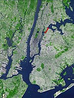
The Hell Gate Bridge, originally the New York Connecting Railroad Bridge or the East River Arch Bridge, is a 1,017-foot (310 m) steel through arch railroad bridge in New York City. Originally built for four tracks, the bridge currently carries two tracks of Amtrak's Northeast Corridor and one freight track across the Hell Gate, a strait of the East River, between Astoria in Queens and Randalls and Wards Islands in Manhattan. The arch across the Hell Gate is the largest of three bridges that form the Hell Gate railroad viaduct. An inverted bowstring truss bridge with four 300-foot (91.4 m) spans crosses the Little Hell Gate, a former strait that is now filled in, and a 350-foot (106.7 m) fixed truss bridge crosses the Bronx Kill, a strait now narrowed by fill. Together with approaches, the bridges are more than 17,000 feet (3.2 mi; 5.2 km) long. The designs of the Tyne Bridge in Newcastle, England and the Sydney Harbour Bridge in New South Wales, Australia were derived from the Hell Gate Bridge.

Excerpt from the Wikipedia article Hell Gate Bridge (License: CC BY-SA 3.0, Authors, Images).

Hell Gate Bridge
Shore Boulevard, New York Queens County

Geographical coordinates (GPS) Address External links Nearby Places
placeShow on map

Wikipedia: Hell Gate BridgeContinue reading on Wikipedia

Geographical coordinates (GPS)

Latitude Longitude
N 40.7824 ° E -73.9217 °
placeShow on map

Address

Hell Gate Bridge

Shore Boulevard
11102 New York, Queens County
New York, United States
mapOpen on Google Maps

linkWikiData (Q1035131)
linkOpenStreetMap (394608567)

Hell Gate Bridge crop
Share experience

Nearby Places

Removal of Hell Gate rocks

The removal of obstructive rocks from Hell Gate, a narrow tidal strait in New York City's East River and a major water transportation route, began in 1849, when French engineer Benjamin Maillefert, cleared some of the rocks. Then in 1851, the U.S. Army Corps of Engineers, led by General John Newton, began to do the job, in an operation which was to span 70 years. On September 24, 1876, the Corps used 50,000 pounds (23,000 kg) of explosives to blast the rocks, which was followed by further blasting. The process was started by excavating under Hallets reef from Astoria. Cornish miners, assisted by steam drills, dug galleries under the reef, which were then interconnected. They later drilled holes for explosives. A patent was issued for the detonating device. After the explosion, the rock debris was dredged and dropped into a deep part of the river. This was not repeated at the later Flood Rock explosion. On October 10, 1885, the Corps carried out the largest explosion in this process, annihilating Flood Rock with 300,000 pounds (140,000 kg) of explosives. The blast was felt as far away as Princeton, New Jersey (50 miles). It sent a geyser of water 250 feet (76 m) in the air. The blast has been described as "the largest planned explosion before testing began for the atomic bomb", although the detonation at the Battle of Messines in 1917 was larger. Some of the rubble from the detonation was used in 1890 to fill the gap between Great Mill Rock and Little Mill Rock, merging the two islands into a single island, Mill Rock.

Randalls and Wards Islands

Randalls Island (sometimes called Randall's Island) and Wards Island are conjoined islands, collectively called Randalls and Wards Islands, in New York County, New York City, separated from Manhattan Island by the Harlem River, from Queens by the East River and Hell Gate, and from the Bronx by the Bronx Kill. The two islands were formerly separated, with Randalls Island to the north of Wards Island. The channel between them, Little Hell Gate, was infilled by the early 1960s. A third, smaller island, Sunken Meadow Island, was located east of Randalls Island and was connected to it in 1955. The island had a population of 1,648 living on 2.09 square kilometers (520 acres) in 2010. Most of the island is parkland, spanning a total of 432.69 acres (175.10 ha), and managed by Randall's Island Park Alliance. The park offers 91 athletic fields, a driving range, greenways, playgrounds and picnic grounds. The island also has a history of being used for asylums, hospitals, and cemeteries, and is currently home to several public facilities, including a psychiatric hospital known as the Manhattan Psychiatric Center, Kirby Forensic Psychiatric Center a Drug and Alcohol Treatment facility named Odyssey House, a daycare, 2 state police stations, FDNY fire academy, a DEP wastewater treatment plant, Icahn Stadium, HELP Clarke Thomas Mens Homeless Shelter, Keener Employment Homeless Mens Shelter, Schwartz Homeless Mens Shelter, HELP USA Supportive Employment Center, and an Urban Farm. Outside of these institutions and buildings, there is no residential housing for the general public on the island. The island is crossed by the Triborough and Hell Gate bridges. The island can be reached by the Triborough Bridge; the Wards Island Bridge, which serves pedestrians and bicyclists and links the island to East Harlem in Manhattan; or by the Randalls Island Connector, a pedestrian and cycling bridge crossing the Bronx Kill and connecting to the Port Morris neighborhood of the Bronx. Randalls Island is the home of three music festivals: Governors Ball Music Festival, Panorama Music Festival, and Electric Zoo Festival.