Malins Lee railway station
Disused railway stations in ShropshireFormer London and North Western Railway stationsPages with no open date in Infobox stationRailway stations in Great Britain closed in 1917Railway stations in Great Britain closed in 1952 ... and 4 more
Railway stations in Great Britain opened in 1862Railway stations in Great Britain opened in 1919Use British English from June 2020West Midlands (region) railway station stubs

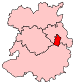
Malins Lee railway station was a station in Malinslee, Shropshire, England. The station was opened in 1862 and closed in 1952. The station site marks the halfway point of the Silkin Way footpath which follows the railway alignment to the south as far as just short of the former Coalport East railway station.
Excerpt from the Wikipedia article Malins Lee railway station (License: CC BY-SA 3.0, Authors, Images).Malins Lee railway station
Downton Close,
Geographical coordinates (GPS) Address External links Nearby Places Show on map
Geographical coordinates (GPS)
| Latitude | Longitude |
|---|---|
| N 52.6747 ° | E -2.4401 ° |
Address
Malins Lee
Downton Close
TF3 2BT , Hollinswood
England, United Kingdom
Open on Google Maps


