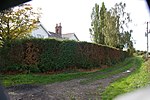
North Duffield
Civil parishes in North YorkshireNorth Yorkshire geography stubsUse British English from November 2019Villages in North Yorkshire

North Duffield is a village and civil parish in the Selby District of North Yorkshire, England. It was historically part of the East Riding of Yorkshire until 1974. It lies about 4 miles (7 km) north-east of Selby and 11 miles (18 km) south-east of York, on the A163 road from Selby to Market Weighton. The River Derwent forms the eastern boundary of the parish. It has an area of around 10,080 acres (4,081 ha) (according to 2001 UK Census data). There are approximately 1,800 residents in the village, the majority of whom are aged between 30 and 50 years. The population at the 2011 Census was 1,317.
Excerpt from the Wikipedia article North Duffield (License: CC BY-SA 3.0, Authors, Images).North Duffield
Manor Drive,
Geographical coordinates (GPS) Address Nearby Places Show on map
Geographical coordinates (GPS)
| Latitude | Longitude |
|---|---|
| N 53.82388 ° | E -0.96239 ° |
Address
Manor Drive
Manor Drive
YO8 5TL , North Duffield
England, United Kingdom
Open on Google Maps


