place

Churchill, Holyoke, Massachusetts
Commons link is defined as the pagenameNeighborhoods in Holyoke, MassachusettsPublic housing in the United States
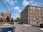
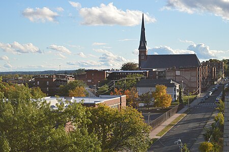
Churchill skyline, Holyoke, Massachusetts

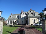
Churchill is a neighborhood in Holyoke, Massachusetts located to the south of the city center, adjacent to the downtown. Its name is a geographic portmanteau as the area was historically known as the Church Hill district prior to its extensive development in the early twentieth century. Located at the southwestern edge of the downtown grid, the area served as housing for mill workers in the late nineteenth and early twentieth century and today contains 166 acres (67 ha) of mixed residential and commercial zoning, including a number of historical brick tenements as well as the headquarters of the Holyoke Housing Authority, Holyoke Senior Center, Churchill Homes public housing, and the Wistariahurst Museum.

Excerpt from the Wikipedia article Churchill, Holyoke, Massachusetts (License: CC BY-SA 3.0, Authors, Images).

Churchill, Holyoke, Massachusetts
Maple Street, Holyoke

Geographical coordinates (GPS) Address Nearby Places
placeShow on map

Wikipedia: Churchill, Holyoke, MassachusettsContinue reading on Wikipedia

Geographical coordinates (GPS)

Latitude Longitude
N 42.200551 ° E -72.615101 °
placeShow on map

Address

Maple Street 428
01040 Holyoke
Massachusetts, United States
mapOpen on Google Maps

Churchill skyline, Holyoke, Massachusetts
Share experience

Nearby Places

Holyoke, Massachusetts

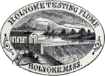
Holyoke is a city in Hampden County, Massachusetts, United States, that lies between the western bank of the Connecticut River and the Mount Tom Range. As of the 2020 census, the city had a population of 38,238. Located 8 miles (13 km) north of Springfield, Holyoke is part of the Springfield Metropolitan Area, one of the two distinct metropolitan areas in Massachusetts. Holyoke is among the early planned industrial cities in the United States. Built in tandem with the Holyoke Dam to utilize the water power of Hadley Falls, it is one of a handful of cities in New England built on the grid plan. During the late 19th century the city produced an estimated 80% of the writing paper used in the United States and was home to the largest paper mill architectural firm in the country, as well as the largest paper, silk, and alpaca wool mills in the world. Although a considerably smaller number of businesses in Holyoke work in the paper industry today, it is still commonly referred to as "The Paper City". Today the city contains a number of specialty manufacturing companies, as well as the Massachusetts Green High Performance Computing Center, an intercollegiate research facility which opened in 2012. Holyoke is also home to the Volleyball Hall of Fame and known as the "Birthplace of Volleyball", as the internationally played Olympic sport was invented and first played at the local YMCA chapter by William G. Morgan in 1895.While managing the Holyoke Testing Flume in the 1880s, hydraulic engineer Clemens Herschel invented the Venturi meter to determine the water use of individual mills in the Holyoke Canal System. This device, the first accurate means of measuring large-scale flows, is widely used in a number of engineering applications today, including waterworks and carburators, as well as aviation instrumentation. Powered by these municipally owned canals, Holyoke has among the lowest energy rates in the Commonwealth, and as of 2016 between 85% and 90% of the city's energy was carbon neutral, with administrative goals in place to reach 100% in the future.