Varroville (homestead)
Farms in New South WalesHomesteads in New South WalesNew South Wales State Heritage RegisterUse Australian English from June 2018

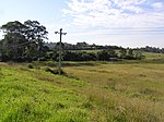
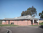
Varroville is a heritage-listed former farm and now rural residence at 196 St Andrews Road, Varroville, New South Wales, Australia. It was designed by Weaver and Kemp and built from 1810 to 1859. It is also known as Varro Ville and Varra Ville. The property is privately owned. It was added to the New South Wales State Heritage Register on 2 April 1999.
Excerpt from the Wikipedia article Varroville (homestead) (License: CC BY-SA 3.0, Authors, Images).Varroville (homestead)
St Andrews Road, Sydney Varroville
Geographical coordinates (GPS) Address Nearby Places Show on map
Geographical coordinates (GPS)
| Latitude | Longitude |
|---|---|
| N -34.004 ° | E 150.826 ° |
Address
St Andrews Road
St Andrews Road
2566 Sydney, Varroville
New South Wales, Australia
Open on Google Maps


