Shrub's Wood Long Barrow

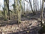
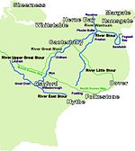
Shrub's Wood Long Barrow is an unchambered long barrow located near to the village of Elmsted in the south-eastern English county of Kent. It was probably constructed in the fourth millennium BCE, during Britain's Early Neolithic period. Built out of earth, the long barrow consists of a sub-trapezoidal tumulus flanked by side ditches. Archaeologists have established that the monument was built by a pastoralist community shortly after the introduction of agriculture to Britain from continental Europe. Although representing part of an architectural tradition of long-barrow building that was widespread across Neolithic Europe, Shrub's Wood Long Barrow belongs to a localised regional variant of barrows produced in the vicinity of the River Stour. Of these, it lies on the eastern side of the river with Julliberrie's Grave, while the third known example in this tumuli group, Jacket's Field Long Barrow, is located on the western side. Shrub's Wood Long Barrow was discovered in the late 1960s, although it has yet to undergo thorough archaeological investigation.
Excerpt from the Wikipedia article Shrub's Wood Long Barrow (License: CC BY-SA 3.0, Authors, Images).Shrub's Wood Long Barrow
Hassell Street,
Geographical coordinates (GPS) Address Nearby Places Show on map
Geographical coordinates (GPS)
| Latitude | Longitude |
|---|---|
| N 51.17357 ° | E 1.00178 ° |
Address
Hassell Street
Hassell Street
TN25 5JF , Wye with Hinxhill
England, United Kingdom
Open on Google Maps


