place

The Met Hotel

Grade II listed buildings in LeedsGrade II listed hotelsHotel buildings completed in 1899Hotels established in 1899Hotels in Leeds
Leeds Blue PlaquesUnited Kingdom listed building stubsUse British English from March 2017Yorkshire building and structure stubs
Hotel Metropole King Street March 2017 01

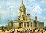
The Met Hotel is a Grade II listed building situated on King Street in Leeds, West Yorkshire, England. Designed by Leeds-based architects Harry Sutton Chorley and J.W. Connon, the hotel opened in 1899 as the Hotel Metropole. The Principal Hayley Group renovated the hotel in 2005, at a cost of £6 million, and changed the name to the trendier sounding 'The Met'. It has four stars and it has 120 rooms. The Hotel Metropole is a listed building, principally because of its rare and remarkable Victorian terracotta facade. The cupola on the roof was taken from the demolished 4th White Cloth Hall, built in 1868 on the same site.

Excerpt from the Wikipedia article The Met Hotel (License: CC BY-SA 3.0, Authors, Images).

The Met Hotel
King Street, Leeds Holbeck Urban Village

Geographical coordinates (GPS) Address Nearby Places
placeShow on map

Wikipedia: The Met HotelContinue reading on Wikipedia

Geographical coordinates (GPS)

Latitude Longitude
N 53.797111111111 ° E -1.5506388888889 °
placeShow on map

Address

Bank of England

King Street
LS1 2HH Leeds, Holbeck Urban Village
England, United Kingdom
mapOpen on Google Maps

Hotel Metropole King Street March 2017 01
Share experience

Nearby Places

City of Leeds
City of Leeds

Leeds, commonly known as the City of Leeds, is a metropolitan borough with city status in West Yorkshire, England. The metropolitan borough includes the administrative centre of Leeds and the towns of Farsley, Garforth, Guiseley, Horsforth, Morley, Otley, Pudsey, Rothwell, Wetherby and Yeadon. It has a population of 811,956 (2021), making it technically the second largest city in England by population behind Birmingham, since London is not a single local government entity. Local governance sits with Leeds City Council and the city's 32 Parish Councils. The current city boundaries were set on 1 April 1974 by the provisions of the Local Government Act 1972, as part a reform of local government in England. The city is a merger of eleven former local government districts; the unitary City and County Borough of Leeds combined with the municipal boroughs of Morley and Pudsey, the urban districts of Aireborough, Garforth, Horsforth, Otley and Rothwell, and parts of the rural districts of Tadcaster, Wharfedale and Wetherby from the West Riding of Yorkshire. For its first 12 years the city had a two-tier system of local government; Leeds City Council shared power with West Yorkshire County Council. Since the Local Government Act 1985 Leeds City Council has effectively been a unitary authority, serving as the sole (aside from the 32 Parish Councils) executive, deliberative and legislative body responsible for local policy, setting council tax, and allocating budget in the city, and is a member of the Leeds City Region Partnership. Although the city's area includes 32 civil parishes, most of Leeds' population currently live in unparished areas. In these areas the Localism Act 2011 makes provision for groups of people from the community, called neighbourhood forums, to formulate Neighbourhood Development Plans and Orders intended to guide and shape development in their own locality.