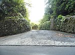
Peaslake

Peaslake, Hoe, and Colman's Hill are in the centre of the Surrey Hills AONB and mid-west of the Greensand Ridge about 5 miles (8.0 km) ESE of Guildford. Surrounded by denser pine and other coniferous forest-clad hills, the three conjoined settlements have a small core in Peaslake itself with the amenities of a village, but are otherwise lightly scattered settlements at a higher elevation than the centre of Shere, the civil parish. The area referred to by the 2011 census covers 302 hectares (750 acres). Friends of the Hurtwood maintains and coppices 3,000 acres (1,200 ha) of surrounding forest, the Hurtwood which comprises: Holmbury Hill, Pitch Hill, Winterfold, Shere Heath, Farley Heath and part of Blackheath Common. It is in the civil parish of Shere. On similar terrain in the far east of the parish and borough is Holmbury St Mary which was used in the 2011 race London-Surrey Cycle Classic – both small villages are centres for hiking and mountain biking.
Excerpt from the Wikipedia article Peaslake (License: CC BY-SA 3.0, Authors, Images).Peaslake
Walking Botttom,
Geographical coordinates (GPS) Address Nearby Places Show on map
Geographical coordinates (GPS)
| Latitude | Longitude |
|---|---|
| N 51.191842 ° | E -0.44692 ° |
Address
Walking Botttom
Walking Botttom
GU5 9RR
England, United Kingdom
Open on Google Maps


