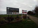
Thurrock Urban District

Thurrock was a local government district and civil parish in south Essex, England from 1936 to 1974. The parish and urban district was formed from the former area of the following civil parishes which had been abolished in 1936: From Grays Thurrock Urban District: Grays Thurrock From Orsett Rural District: Bulphan Corringham East Tilbury Fobbing Horndon-on-the-Hill Langdon Hills Little Thurrock Mucking North Ockendon (part) Orsett Stanford-le-Hope Stifford West Tilbury From Purfleet Urban District: Aveley South Ockendon West Thurrock From Tilbury Urban District: Chadwell St MaryThe district was enlarged in 1938 by gaining part of the former Little Burstead parish from Billericay Urban District. The district was abolished in 1974. The part within Basildon New Town became part of Basildon District, while the remainder became the present-day Borough of Thurrock. It has since become a unitary authority with largely the same boundaries.
Excerpt from the Wikipedia article Thurrock Urban District (License: CC BY-SA 3.0, Authors, Images).Thurrock Urban District
Long Lane, Thurrock
Geographical coordinates (GPS) Address Nearby Places Show on map
Geographical coordinates (GPS)
| Latitude | Longitude |
|---|---|
| N 51.5 ° | E 0.35 ° |
Address
Long Lane
Long Lane
RM16 2QP Thurrock
England, United Kingdom
Open on Google Maps


