place

Long Pond (West Yarmouth, Massachusetts)

Lakes of Barnstable County, MassachusettsLakes of Massachusetts

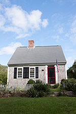
Long Pond is a lake in Barnstable County, Massachusetts. It is located in South Yarmouth.

Excerpt from the Wikipedia article Long Pond (West Yarmouth, Massachusetts) (License: CC BY-SA 3.0, Authors).

Long Pond (West Yarmouth, Massachusetts)
Lakeland Avenue,

Geographical coordinates (GPS) Address Nearby Places
placeShow on map

Wikipedia: Long Pond (West Yarmouth, Massachusetts)Continue reading on Wikipedia

Geographical coordinates (GPS)

Latitude Longitude
N 41.669742 ° E -70.1971508 °
placeShow on map

Address

Lakeland Avenue 59
02664
Massachusetts, United States
mapOpen on Google Maps

Share experience

Nearby Places

Red Wilson Field
Red Wilson Field

Merrill "Red" Wilson Field is a baseball venue in Yarmouth, Massachusetts, home to the Yarmouth–Dennis Red Sox of the Cape Cod Baseball League (CCBL). Dennis-Yarmouth Regional High School is located to the southwest of the field. Red Wilson Field is one of three CCBL ballparks that does not have lights. Constructed in 1957, the field began to be used regularly as the home field of the then "Yarmouth Red Sox" in 1973. In 1981 the field was renamed in honor of Merrill "Red" Wilson, a beloved teacher, administrator, coach and athletic director at Dennis-Yarmouth High School. Wilson was a seven-time CCBL all-star catcher for Yarmouth in the late 1950s and early 1960s. He went on to manage the team for 16 seasons and was inducted into the CCBL Hall of Fame as part of its inaugural class in 2000. Major improvements were made to Red Wilson Field thanks to a 2009 grant from the Yawkey Foundation. The ballpark hosted the CCBL's annual all-star game and home run derby festivities in 1996, 2006 and 2013, and has seen the Red Sox claim eight CCBL league titles, most recently in the three consecutive seasons from 2014 to 2016. The ballpark has been the summertime home of dozens of future major leaguers such as Buster Posey, Craig Biggio and Chris Sale. The creative culinary offerings of the concession stand at Red Wilson Field have garnered national media attention from such publications as Baseball America, The Boston Globe, and MLB.com. Thousands of "donut burgers" have been sold at the ballpark since the concept was introduced in 2004 by its creator, "Burger Bob" Phillips. In lieu of a traditional hamburger bun, patrons can opt to order their burger served between the sliced halves of a donut. Various donut and topping combinations are given baseball-themed nicknames with gastric double-entendres such as "The Hurler", "The Sinker", and "The Boston Screamer".

South Yarmouth/Bass River Historic District

The South Yarmouth/Bass River Historic District is a historic district in the southeastern part of Yarmouth, Massachusetts. It encompasses a predominantly residential area centered on a portion of Old Main Street and South Street between the villages of South Yarmouth and Bass River. The area's history is one of maritime-related industry from the late 18th to late 19th century, and then its growth as a tourist resort community. The district was listed on the National Register of Historic Places in 1990.Although Yarmouth was settled in the 17th century, its southern portions did not begin developing until around the time of American independence in the late 18th century, since much of the land had been set aside as an Indian reservation. A major smallpox epidemic crippled the Indian population, and the reservation lands were sold off. The area along the Bass River developed a maritime economy. By the turn of the 19th century it was one of the economic centers of Barnstable County. Although remnants of older buildings survive as parts of others, the oldest buildings in the district date to the 1790s, and the oldest major civic structure in the district is the Friends Meeting House (1809), and its adjacent burial ground.With the growth of the maritime industries, a variety of housing was built between 1800 and the 1850s, in architectural styles (Cape, Federal, and Greek Revival) popular during that time. These forms are those most commonly seen in the district. Other churches joined the Quaker meeting house: the Baptist Church in 1826 and the Methodist Church in 1852. Maritime industry began a decline in the second half of the 19th century, but the arrival of the railroads heralded the beginning of the area's conversion to a summer resort destination, and the area around Main Street and the bridge across the Bass River took shape as the main village center of South Yarmouth with the construction of a number of retail and commercial buildings. A number of buildings in later 19th century styles, including Gothic, Queen Anne, and Craftsman styles, are included in the district.In the 20th century, the development of Route 28 bypassed the section of Main Street (now Old Main Street), while other sections of Main Street which were included in expansions of Route 28 became more heavily developed with modern buildings.

Dennis Beaches
Dennis Beaches

The Dennis Beaches, are a series of beaches in Dennis, Massachusetts, on Cape Cod. There are a total of eighteen beaches; sixteen located on the ocean and two located on fresh water ponds. Eight of the ocean beaches, Mayflower, Corporation, Bayview, Howes Street, Chapin Memorial, Cold Storage and Harbor View, are located on the northern (bay side) of the Cape and Islands. The remainder of the beaches, including Depot Street, Glendon Rd, Haigis, Inman Rd., Raycroft, Sea Street, South Village and West Dennis, are located on the southern side of the Cape and Islands. Princess and Scargo, both on Scargo Lake, are the two fresh water ponds, and both are located on the northern side as well.Chapin Memorial Beach, which was previously known as Black Flats for its black sands and extensive tidal flats, was named in honor of George H. Chapin, a real estate developer who donated the land to the Town after World War II. Corporation Beach, which is also sometimes called Nobscussett Beach, was named for the Nobscussett Point Pier Corporation. It is located on the east side of Nobscusset Point. Nobscussett is possibly related to the Algonquian word wanashqu, which means at the end of the rock. Mayflower Beach was acquired by the Town in 1977 by eminent domain. It is named for the failed Mayflower Beach Condominiums Complex. At the other end of Mayflower Beach is Bayview Beach, which has a parking lot for residents only. Hippogriffe Road was named for a 678-ton clipper ship built in 1852 at the Shiverick Yards.Glennon Road, and the beach named for the street, took their name from Hubert Glennon, a Marine officer who served as the Columbia University rowing coach after World War II, and who donated the beach to the village. To the west is Peter Hagis Beach, which is located on land donated by his widow. Also in the village is Inman Road Beach, named for the Inman family (including Isaiah Inman) who lived on the corner of Lower County Road. Raycroft Beach was named for Louis B. Raycroft, who often summered near Old Wharf Road and Sea Street.Cold Storage Beach was named for the storehouses in the area that kept fish cold in the early 1900s. Aunt Julia Ann Road, and the beach by the same name, is found on the Bass River, across from the Bass River Golf Club. It is named for Julia Ann Baker, the third wife and widow of Levi Baker. West Dennis Beach was once known as Davis Beach, and the road that runs along the length of the beach is Davis Beach Road. Charles Henry Davis sold the beach to the Town in the early 1900s.South Village Beach was named for the fishing hamlet once located in West Dennis called South Village.

Bass River (Massachusetts)

Bass River is an estuary and village in South Yarmouth, Massachusetts, United States. The estuary separates the towns of Yarmouth and Dennis at the central, southern sections of the towns. At its widest and most southerly point, it opens to and meets Nantucket Sound. Its brackish, northwestern end flows into Follins Pond, from there winding further north as a brook, to Mill Pond then an underground stream that nearly bisects Cape Cod. The mouth of the river is between Smugglers Beach on the Yarmouth side and West Dennis Beach on the Dennis side. West Dennis beach has become a popular site for kite boarding in the past few years. In the same way, Kalmus Beach in Hyannis has become popular for windsurfing. Once inside the river, there is a large land mass covered with sea grass, in the middle of which is a large bay. The island is called 'Marsh Island' by the locals. Marsh Island separates Bass River into two parts. The right side of the river, which is referred to as the 'Old Field Channel', goes towards West Dennis and the Fingers development. The left side is the main channel of the river, passing Windmill Beach, Bass River Yacht Club, Ship Shops Marina and the prestigious Bass River Marina and Yacht Club. After the marina, the river goes under the Route 28 bridge and winds five more miles deep into the cape. Bass River was once considered a viable location for a canal traversing Cape Cod, and is the largest river the Mid-Cape Highway spans. Bass River is home to a friendly rivalry between West Dennis Yacht Club and the Bass River Yacht Club. These clubs also compete against Hyannis Yacht Club, Wianno Yacht Club, and others in the Southern Massachusetts Sailing Association team racing circuit. The Yarmouth shores are home to Bass River Golf Course, which is owned and operated by the town of Yarmouth. There is another Bass River in the city of Beverly.