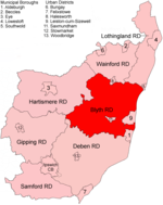
East Suffolk District

East Suffolk is a local government district in Suffolk, England. The largest town is Lowestoft, which contains Ness Point, the easternmost point of the United Kingdom. The second largest town is Felixstowe, which has the country's largest container port. On the district's south-western edge it includes parts of the Ipswich built-up area. The rest of the district is largely rural, containing many small towns and villages, including several seaside resorts. Its council is based in the village of Melton. The district was formed in 2019 as a merger of the two previous districts of Suffolk Coastal and Waveney. In 2021 it had a population of 246,058. It is the most populous district in the country not to be a unitary authority. The district is on the coast, facing the North Sea. Much of the coast and adjoining areas lies within the Suffolk Coast and Heaths, a designated Area of Outstanding Natural Beauty. Some northern parts of the district lie within The Broads. The neighbouring districts are Babergh, Ipswich, Mid Suffolk, South Norfolk and Great Yarmouth.
Excerpt from the Wikipedia article East Suffolk District (License: CC BY-SA 3.0, Authors, Images).East Suffolk District
The Street, East Suffolk
Geographical coordinates (GPS) Address Nearby Places Show on map
Geographical coordinates (GPS)
| Latitude | Longitude |
|---|---|
| N 52.2 ° | E 1.5 ° |
Address
The Street
The Street
IP17 1ND East Suffolk
England, United Kingdom
Open on Google Maps


