Sandlings Walk
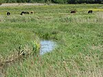
The Sandlings Walk is a long-distance path in Suffolk, England. It runs 91.6km through the Suffolk Sandling that used to stretch from the outskirts of Ipswich to Southwold which is an area of lowland heath, Britain's rarest wildlife habitat, and the Suffolk Coast and Heaths Area of Outstanding Natural Beauty. Starting on the outskirts of Ipswich (trailheads at 52.0620°N 1.2053°E / 52.0620; 1.2053 (Sandlings Walk (Ipswich trailhead)), 52.0548°N 1.2022°E / 52.0548; 1.2022 (Sandlings Walk (Ipswich trailhead)), and 52.0420°N 1.1985°E / 52.0420; 1.1985 (Sandlings Walk (Ipswich trailhead))), the route passes through Rushmere Common, Sutton Heath, Rendlesham Forest, Butley Corner, Tunstall Forest, Friston, North Warren, Thorpeness, Sizewell, Minsmere, Dunwich Heath, Dunwich Forest, the Suffolk Coast National Nature Reserve and Southwold (trailhead at 52.3231°N 1.6772°E / 52.3231; 1.6772 (Sandlings Walk (Southwold trailhead))).
Excerpt from the Wikipedia article Sandlings Walk (License: CC BY-SA 3.0, Authors).Sandlings Walk
Priory Road, East Suffolk
Geographical coordinates (GPS) Address Nearby Places Show on map
Geographical coordinates (GPS)
| Latitude | Longitude |
|---|---|
| N 52.1751 ° | E 1.5117 ° |
Address
Priory Road
Priory Road
IP17 1RZ East Suffolk
England, United Kingdom
Open on Google Maps


