place

Neutral Moresnet

1816 establishments in Europe1920 disestablishments in EuropeCondominia (international law)Disputed territories in EuropeEsperanto history
German-speaking Community of BelgiumKelmisNeutral MoresnetStates and territories disestablished in 1920States and territories established in 1816Territorial disputes of Germany
Flag of Moresnet
Flag of Moresnet

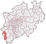
Neutral Moresnet (French pronunciation: ​[mɔʁɛsnɛt], [mɔʁɛsnɛ], German pronunciation: [ˈmɔʁəsnɛt], [ˌmɔʁəsˈnɛt]) was a small Belgian–Prussian condominium in western Europe that existed from 1816 to 1920 and was administered jointly by the United Kingdom of the Netherlands (Belgium after its independence in 1830) and the Kingdom of Prussia. It was 1.5 kilometres (1 mi) wide and five kilometres (3 mi) long, with an area of 360 hectares (900 acres). After 1830, the territory's northernmost border point at Vaalserberg connected it to a quadripoint shared additionally with the Dutch Province of Limburg, the Prussian Rhine Province, and the Belgian Liège Province. Its former location is represented presently by the Three-Country Point, the meeting place of the borders of Belgium, Germany, and the Netherlands. During the First World War, Neutral Moresnet was annexed by Germany, although the allies did not recognise the annexation. The armistice between France and Germany in November 1918 forced Germany to withdraw from Belgium and Neutral Moresnet. A year later, the Treaty of Versailles awarded Neutral Moresnet to Belgium, effective 10 January 1920, when the territory was annexed by Belgium to become the municipality of Kelmis. During World War II, Kelmis and the area surrounding was again annexed by Germany and had its name reverted to Moresnet, but the territory was returned to Belgium during 1944.

Excerpt from the Wikipedia article Neutral Moresnet (License: CC BY-SA 3.0, Authors, Images).

Neutral Moresnet
Ruhrstrasse,

Geographical coordinates (GPS) Address Nearby Places
placeShow on map

Wikipedia: Neutral MoresnetContinue reading on Wikipedia

Geographical coordinates (GPS)

Latitude Longitude
N 50.730277777778 ° E 6.0133333333333 °
placeShow on map

Address

Ruhrstrasse
4720 (Kelmis (Altgemeinde))
Liège, Belgium
mapOpen on Google Maps

Flag of Moresnet
Flag of Moresnet
Share experience

Nearby Places

Kelmis
Kelmis

Kelmis (German pronunciation: [ˈkɛlmɪs]; French: La Calamine, French pronunciation: ​[la kalamin]) is a municipality located in the Belgian province of Liège, named for the historical deposits of calamine (zinc ore) nearby. As of 2011, the population was 10,881; the area is 18.1 square kilometres (7.0 sq mi) and the population density is 601.2 inhabitants per square kilometre (1,557/sq mi).The municipality consists of the following sub-municipalities: Kelmis proper, Hergenrath, and Neu-Moresnet. The territory around the Vieille Montagne zinc mine in Kelmis was Neutral Moresnet, a neutral condominium of the Netherlands and Prussia (later Belgium and Germany) from 1816 to 1919, with the Mayor of Kelmis nominated by two commissioners from the neighbouring countries. Although there were attempts by locals at making it evolve into a fully independent microstate, all of them were thwarted and it remained under double-sovereignty and neutrality until its eventual annexation by Belgium after the First World War. There is a war memorial to German soldiers from Kelmis who were killed during the Franco-Prussian War, located in the Aachener Strasse, and one to inhabitants of Kelmis who were killed in the First and Second World Wars, located in the Kirchplatz (French: Place de l'Église).A small museum in Kelmis, the Museum Vieille Montagne, includes exhibits on Neutral Moresnet. Of the 60 border markers for the territory, more than 50 are still standing.In the nineteenth century a Low Dietsch dialect was spoken in Kelmis. Today Kelmis is German-speaking. It has facilities for French speakers and is one of the nine municipalities of the German‑speaking Community of Belgium.