place

Praia da Adraga

Beaches of Lisbon DistrictSintra
Praia da adraga 1
Praia da adraga 1

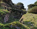
Praia da Adraga is a North Atlantic beach in Portugal, near to the town of Almoçageme, Sintra. It has been recommended in British newspapers. It is a "Blue Flag beach" with access for handicapped persons, It has an excellent restaurant and a very good emergency service system, although it is hard to reach by public transportation. Because of its beauty it has been the subject of many photographs and many blogs.

Excerpt from the Wikipedia article Praia da Adraga (License: CC BY-SA 3.0, Authors, Images).

Praia da Adraga
Rua Praia da Adraga,

Geographical coordinates (GPS) Address Nearby Places
placeShow on map

Wikipedia: Praia da AdragaContinue reading on Wikipedia

Geographical coordinates (GPS)

Latitude Longitude
N 38.804444444444 ° E -9.485 °
placeShow on map

Address

Gruta da Adraga

Rua Praia da Adraga
2705-063 (Colares)
Portugal
mapOpen on Google Maps

Praia da adraga 1
Praia da adraga 1
Share experience

Nearby Places

Praia das Maçãs Prehistoric Monument

The Praia das Maçãs Prehistoric Monument, also known as the Tholos of Outeiro das Mós, consists of an artificial Neolithic cave and a Chalcolithic domed or beehive tomb. It is situated close to the Praia das Maçãs beach, near the town of Colares in Sintra municipality, in the Lisbon District of Portugal. The area was discovered in 1927. As an important prehistoric sepulchral site, it was classified as a national monument in 1974. Surrounded by housing, the location has been designated as a special zone of protection, and construction is forbidden. Plans by Sintra and the Directorate-General for Cultural Heritage to turn the complex into a museum area, first discussed in 2001, have not yet been implemented. For purposes of protection the site has been covered by sand and there is little presently visible. The artificial cave was probably dug into the rock in the second half of the 4th millennium BC or early in the 3rd. The tholos was added later. The site is seen as a good example of the practice of re-appropriation of symbolic locations, resulting in funeral practices of two different eras coexisting in the same space. After discovery of the site by an agricultural worker in 1927 there were limited excavations by the National Museum of Archaeology and Ethnology but little work on the necropolis was really carried out until archaeologists Vera Leisner, Georges Zbyszewski and Octávio da Veiga Ferreira excavated it, starting in 1969, after having seen items discovered unofficially by a private collector in the 1930s. Further work by Sintra Council was carried out in 1981. The Neolithic cave has a diameter of around 2 m (6 ft 7 in) and was originally covered with stone supports. The later tholos was composed of a circular chamber with a diameter of approximately 5.5 m (18 ft). Walls were constructed with limestone slabs placed horizontally. A pillar was raised in the centre to support a dome. An access corridor, about 3.5 m (11 ft) long, connected the chamber to a 2-metre-wide atrium. Items found at the site have included geometric microliths, arrowheads, polished axes, and cylindrical idols. These have been preserved at the National Museum of Archaeology and Ethnology in Lisbon, and the Regional Museum of Sintra.

Anta de Adrenunes
Anta de Adrenunes

The Anta de Adrenunes, located on top of a hill at 426 metres above sea level, in the municipality of Sintra, within Sintra-Cascais Natural Park, Lisbon District, Portugal, is believed to be a Stone Age burial chamber or megalithic monument. It is a structure consisting of a cluster of granite stones, between which there is a gallery about 5 metres high that is surmounted by monoliths that rest horizontally on vertical stones. The passage is thought to have served as a collective necropolis or dolmen during the megalithic period although no artifacts or burial chambers have been found to prove this. The site contains a geodesic landmark that has been inserted into one of the upper stones.Initial excavations by Joaquim Possidónio Narciso da Silva (1806-1896) found no evidence of funerary use. However, Da Silva presented the results of his research at one of the sessions of the International Congress of Anthropology and Prehistoric Archeology in 1871, referring to the site as a megalithic funerary monument. Later writers have argued that the site combines natural granite rocks, which are also found elsewhere in the area, with some architectural elements. They point to the layout of the rocks and their orientation to the sunset to argue that this suggests a megalithic structure that was probably of natural origin and was later worked on by humans. More recent excavations of the stones have provided some evidence of the intervention of humans, as granite wedges in the foundations of some of the stones have been identified. The approximately rectangular shape of some of the rocks also provides possible evidence of human intervention, although other writers have argued that the site is no more than a natural collection of rocks. Visiting the site requires a walk of about one kilometre from a tarred road. It receives relatively few visitors, although it is popular at the time of solstices and equinoxes.