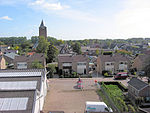
Lede en Oudewaard
AC with 0 elementsFormer municipalities of GelderlandGelderland geography stubsNeder-BetuwePopulated places in Gelderland

Lede en Oudewaard is a hamlet in the Dutch province of Gelderland. It is a part of the municipality of Neder-Betuwe, and lies about 8 km west of Wageningen. Lede en Oudewaard was a separate municipality between 1818 and 1822, at which time it was merged with Kesteren.Lede was first mentioned probably in 1235 as ter Lee, and means "dug stream". Oudewaard was first mentioned in 1326 as "de Weert te Kester", and means the old land near water. The postal authorities have placed the hamlet under Kesteren. Until 1800, it was an heerlijkheid. In 1840, it was home to 147 people.
Excerpt from the Wikipedia article Lede en Oudewaard (License: CC BY-SA 3.0, Authors, Images).Lede en Oudewaard
Hoge Dijkseweg, Neder-Betuwe
Geographical coordinates (GPS) Address Nearby Places Show on map
Geographical coordinates (GPS)
| Latitude | Longitude |
|---|---|
| N 51.9403 ° | E 5.5551 ° |
Address
Hoge Dijkseweg 9a
4041 AW Neder-Betuwe
Gelderland, Netherlands
Open on Google Maps


