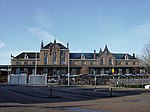
Est, Netherlands
Gelderland geography stubsPopulated places in GelderlandWest Betuwe

Est is a village in the Dutch province of Gelderland. It is a part of the municipality of West Betuwe, and lies about 8 km west of Tiel. It was first mentioned in 1316 as Est. The etymology is unclear. The church dates from 1750 and has been restored in 1999. The village pump dates from around 1770, and is still in working order. In 1840, Est was home to 588 people.
Excerpt from the Wikipedia article Est, Netherlands (License: CC BY-SA 3.0, Authors, Images).Est, Netherlands
Dorpsstraat, West Betuwe
Geographical coordinates (GPS) Address Website Nearby Places Show on map
Geographical coordinates (GPS)
| Latitude | Longitude |
|---|---|
| N 51.8525 ° | E 5.3136111111111 ° |
Address
Henk Jonkers
Dorpsstraat 18
4185 NA West Betuwe
Gelderland, Netherlands
Open on Google Maps


