place

Murray Hill (Ulster County, New York)

Catskill Mountains, New York geography stubsMountains of New York (state)Mountains of Ulster County, New York

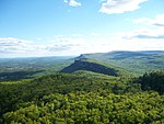
Murray Hill is a mountain located in the Catskill Mountains of New York east-northeast of Ellenville. Murray Hill was named after a former landowner. Margaret Cliff is located east, and Mount Don Bosco is located west-southwest of Murray Hill.

Excerpt from the Wikipedia article Murray Hill (Ulster County, New York) (License: CC BY-SA 3.0, Authors).

Murray Hill (Ulster County, New York)
Scenic Trail / SRT (Violet/Blue Blazes),

Geographical coordinates (GPS) Address Nearby Places
placeShow on map

Wikipedia: Murray Hill (Ulster County, New York)Continue reading on Wikipedia

Geographical coordinates (GPS)

Latitude Longitude
N 41.6975 ° E -74.296944444444 °
placeShow on map

Address

Scenic Trail / SRT (Violet/Blue Blazes)

Scenic Trail / SRT (Violet/Blue Blazes)

New York, United States
mapOpen on Google Maps

Share experience

Nearby Places

Pearl Street Schoolhouse

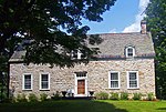
The Pearl Street Schoolhouse, also known as District 11 Schoolhouse, is located south of the junction of Awosting and Decker roads in the Town of Shawangunk, New York, United States. It was built around 1850. The schoolhouse name is derived from the tendency of the Jansen family to speak often of Pearl Street in what is today Lower Manhattan. The homes of early settlers Thomas and Johannes are within a mile (1.6 km) of each other. Eventually, the whole area they lived in became known as Pearl Street.The building, now a private home, was added to the National Register of Historic Places in 1983. It is a single-story three-by-three-bay frame structure on a stone foundation, now parged with concrete. A gabled roof is pierced by a brick chimney. To the west a modern shed-roofed wing on block piers projects.Inside, the single room has been divided into two large spaces. Much of the original woodwork, including the wainscoting, remains. Other signs of the building's use as a school are evident, particularly the coat pegs near the south door, a black spot on the floor where the potbelly stove was and a hole in the wall for its exhaust pipe.The first record of the building is an 1858 atlas describing the building as a store with the school across the street; however this is believed to be in error because of the building's architecture. In 1875 another atlas describes it as Public School No. 11. It remained in use as a school until 1942-43, after which it was sold for use as a private residence. In 1956 the rear wing was added, and it was expanded nine years later, adding two more rooms to the house.

Shawangunk Ridge
Shawangunk Ridge

The Shawangunk Ridge , also known as the Shawangunk Mountains or The Gunks, is a ridge of bedrock in Ulster County, Sullivan County and Orange County in the state of New York, extending from the northernmost point of the border with New Jersey to the Catskills. The Shawangunk Ridge is a continuation of the long, easternmost section of the Appalachian Mountains; the ridge is known as Kittatinny Mountain in New Jersey, and as Blue Mountain as it continues through Pennsylvania. This ridge constitutes the western border of the Great Appalachian Valley. The ridgetop, which widens considerably at its northern end, has many public and private protected areas, including Wurtsboro Ridge State Forest, Shawangunk Ridge State Forest, Minnewaska State Park Preserve, Witch's Hole State Park and Mohonk Preserve. The ridge is not heavily populated; its only settlement of consequence is the hamlet of Cragsmoor. In the past, the ridge was chiefly noted for mining and logging and a boom-era of huckleberry picking. Fires were regularly set to burn away the undergrowth and stimulate new growth of huckleberry bushes. Today the ridge has become known for its outdoor recreation, most notably as one of the major rock climbing areas of North America, with many guides offering rock climbing trips in the area. Also known for its biodiversity and scenic character, the ridge has been designated by The Nature Conservancy as a significant area for its conservation programs.