Chestfield
City of CanterburyCivil parishes in KentKent geography stubsVillages in Kent

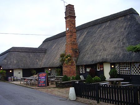
Chestfield is a village (and civil parish and with Swalecliffe a district council ward) in the Canterbury District of Kent, England. The parish is centred 0.5 miles (0.80 km) from the sea on the north coast of Kent, between the towns of Whitstable and Herne Bay. It is approximately five miles (8 km) north of Canterbury. Over a third of the parish, all of which is the south of its ambit, is woodland. The north-west consists of a business park and superstore.
Excerpt from the Wikipedia article Chestfield (License: CC BY-SA 3.0, Authors, Images).Chestfield
Chestfield Road,
Geographical coordinates (GPS) Address Nearby Places Show on map
Geographical coordinates (GPS)
| Latitude | Longitude |
|---|---|
| N 51.355 ° | E 1.064 ° |
Address
Chestfield Road
Chestfield Road
CT5 3JH
England, United Kingdom
Open on Google Maps


