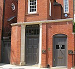
Glebe Place
Chelsea, LondonKing's Road, Chelsea, LondonStreets in the Royal Borough of Kensington and Chelsea

Glebe Place is a street in Chelsea, London. It runs roughly north to south from King's Road to the crossroads with Upper Cheyne Row, where it becomes Cheyne Row, leading down to Cheyne Walk and the River Thames. It also has a junction with Bramerton Street. The street was known as Cook's Ground for some period up to the mid-nineteenth century.
Excerpt from the Wikipedia article Glebe Place (License: CC BY-SA 3.0, Authors, Images).Glebe Place
Glebe Place, London Chelsea (Royal Borough of Kensington and Chelsea)
Geographical coordinates (GPS) Address Nearby Places Show on map
Geographical coordinates (GPS)
| Latitude | Longitude |
|---|---|
| N 51.485683333333 ° | E -0.16988611111111 ° |
Address
Glebe Studios,
Glebe Place 60-61
SW3 5JB London, Chelsea (Royal Borough of Kensington and Chelsea)
England, United Kingdom
Open on Google Maps


