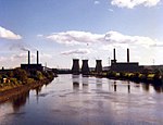
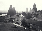
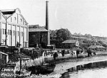
The Stella power stations were a pair of now-demolished coal-fired power stations in the North East of England that were a landmark in the Tyne valley for over 40 years. The stations stood on either side of a bend of the River Tyne: Stella South power station, the larger, near Blaydon in Gateshead, and Stella North power station near Lemington in Newcastle. Their name originated from the nearby Stella Hall, a manor house close to Stella South that by the time of their construction had been demolished and replaced by a housing estate. They operated from shortly after the nationalisation of the British electrical supply industry until two years after the Electricity Act of 1989, when the industry passed into the private sector.
These sister stations were of similar design and were built, opened, and closed together. Stella South, with a generating capacity of 300 megawatts (MW), was built on the site of the Blaydon Races, and Stella North, with a capacity of 240 MW, on that of the former Lemington Hall. They powered local homes and the many heavy industries of Tyne and Wear, Northumberland and County Durham. The large buildings, chimneys and cooling towers were visible from afar. Their operation required coal trains on both sides of the river to supply them with fuel and river traffic by flat iron barges to dump ash in the North Sea. After their closure in 1991, they were demolished in stages between 1992 and 1997. Following the stations' demolition, the sites underwent redevelopment: the North site into a large business and industrial park, the South into a housing estate.


