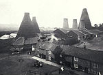
Lemington Power Station

Lemington Power Station was a small, now demolished coal-fired power station, located in North East England. It was situated on the Lemington Gut, a backwater of the River Tyne, at Lemington, 3.5 mi (5.6 km) west of Newcastle upon Tyne. The station's main building stood until 2017 as a rare example of an early power station, dating from before the nationalisation of the United Kingdom's electrical supply industry. The station was opened in 1903 with a total generating capacity of 970 kilowatts, the electricity generated being used to power a tram system, and provide local households and streets with electric lighting. The station ceased generating electricity in 1919, however the structure was retained for use as a sub-station until 1946 when the tram line closed. The station was partially demolished in 1949, but was made a locally listed building and its site currently owned by construction company Nortland Construction. In March 2012 Norland applied to Newcastle City Council for permission to demolish the building on the grounds of it being at risk of collapse. The station was finally demolished in 2017.
Excerpt from the Wikipedia article Lemington Power Station (License: CC BY-SA 3.0, Authors, Images).Lemington Power Station
Scotswood Road, Newcastle upon Tyne Lemington
Geographical coordinates (GPS) Address Nearby Places Show on map
Geographical coordinates (GPS)
| Latitude | Longitude |
|---|---|
| N 54.974444444444 ° | E -1.7116666666667 ° |
Address
Scotswood Road
Scotswood Road
NE15 8SE Newcastle upon Tyne, Lemington
England, United Kingdom
Open on Google Maps


