place

Entlibühl

Former islandsGeography of ThurgauIsland stubsIslands of Lake Constance in GermanyThurgau geography stubs

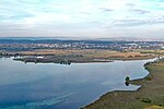
Entlibühl or Äntebüel, formerly also Koschmannskeller Kopf was a small island in the Untersee, itself part of Lake Constance. It lay around 30 metres off the Swiss shore below Gottlieben in the Canton of Thurgau. The island is shown on historical maps by the Swisstopo from 1966 to 1995 off the western boundary of the municipality of Gottlieben with its former neighbour, Triboltingen (1975 incorporated into Ermatingen). From 2003 the name Äntebüel is found on the map in dark blue lettering surrounded by an enclosed isobath, i.e., designating a hydrographical object such as a shallows. A cartometric measurement of the former island gives a length from east to west of 70 metres, a maximum width of 25 metres and an area of around 1,100 square metres or 0.11 hectares. The name Äntebüel means 'bank in the water on which ducks like to rest'.The island consisted mainly of sea chalk (Schnegglisand). In a 1911 publication it stated: "The Schnegglisands are widely distributed in the Untersee. In the area of the lake they can also be found on the Langenrain. (by the Swiss shore!) opposite the islet of Entlibühl or Koschmannskeller Kopf, which at low tide forms an extensive bank of approx. 300 m length and 150 m width, and reaches up to the shore there. It lies in a thickness of 40-70 cm directly on the Seeletten [lake clay], its strata have a wave-like appearance. (Effect of the waves and the current.)"

Excerpt from the Wikipedia article Entlibühl (License: CC BY-SA 3.0, Authors).

Geographical coordinates (GPS)

Latitude Longitude
N 47.665861111111 ° E 9.1164722222222 °
placeShow on map

Address

Espenweg

Espenweg
8273
Thurgau, Switzerland
mapOpen on Google Maps

Share experience

Nearby Places

Triboldingerbohl
Triboldingerbohl

Triboldingerbohl, also known as Triboltingen or großes Bohl or Langenrain, is the fourth largest island of Lake Constance, with an area of 0.13557 square kilometres (0.05234 sq mi). It is 780 meters (2,560 ft) long and up to 230 meters (750 ft) wide. It is located in the easternmost part of the Untersee (Lake Constance), near the point where the Seerhein flows into the lake. This part of the lake is also known as the Rheinsee. It belongs to the Wollmatinger Ried nature conservation area; administratively it belongs to the district industrial area of the City of Constance. Until 1934, it belonged to the municipality of Wollmatingen, which was then annexed by Constance. Triboldingerbohl lies 2.1 km (1.3 mi) southeast of Reichenau Island and 1.6 km (0.99 mi) from the dam that connects Reichenau to the mainland. The area between Triboldingerbohl island and the Reichenau dam is called Ermatinger pool and is an ecologically important shallow-water zone. Triboldingerbohl is uninhabited. It is a bird sanctuary. It takes its name from the former Swiss municipality Triboltingen, which was located on the southern shore of Lake Untersee. Between Triboldingerbohl and the mainland lies the smaller island of Mittler Bohl, also known as Langbohl. The two islands are separated by a channel which is only 30 to 50 meters (98 to 164 ft) wide. This channel and the channel separating Langbohl from the mainland are collectively known as Schläuche ("tubes"). Both island are covered with reeds. They consist of a several meters thick layer of Schnegglisand, a calcareous deposits from Blue-green algae), which is covered by a layer of humus. Although the island is uninhabited, it is listed in the Constance street directory. It falls under postal code 78467 (Constance-Wollmatingen).