place

Hingham, Norfolk

Civil parishes in NorfolkHingham, NorfolkLincoln familyMarket towns in NorfolkSouth Norfolk
Towns in Norfolk
Georgian Houses, Hingham (696611 f9c2dc32 by Evelyn Simak)

Hingham is a market town and civil parish in mid-Norfolk, England. The civil parish covers an area of 14.98 km2 (5.78 sq mi) and had a population of 2,078 in 944 households at the time of the 2001 census, increasing to 2,367 at the 2011 Census.Grand architecture surrounds the historic market place and town greens. According to an 18th-century source, a fire destroyed many of the town's buildings, leading the better-off local families to build the handsome Georgian homes for which the town is known. The same source claims that the Hingham gentry were "so fashionable in their dress that the town is called by the neighbours 'Little London'".Hingham is 13 miles (21 km) west from Norwich, Norfolk's county town. While many Hingham people now work in Norwich, commuting by car or bus, the town has maintained a range of shops and businesses in its historic streets and an industrial estate on Ironside Way. Despite the influence and attractions of Norwich, an active and independent town life continues to thrive and grow in Hingham. A fair visits every year, setting up on the historic Fairlands (an area of several triangular greens). There is a state-run school, providing education for children from the ages of 4–11. The nearest railway stations are Wymondham and Attleborough, both on the Breckland Line.

Excerpt from the Wikipedia article Hingham, Norfolk (License: CC BY-SA 3.0, Authors, Images).

Hingham, Norfolk
Church Street, South Norfolk

Geographical coordinates (GPS) Address Nearby Places
placeShow on map

Wikipedia: Hingham, NorfolkContinue reading on Wikipedia

Geographical coordinates (GPS)

Latitude Longitude
N 52.5791 ° E 0.98284 °
placeShow on map

Address

Church Street
NR9 4HL South Norfolk
England, United Kingdom
mapOpen on Google Maps

Georgian Houses, Hingham (696611 f9c2dc32 by Evelyn Simak)
Share experience

Nearby Places

Great Ellingham
Great Ellingham

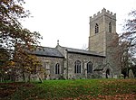
Great Ellingham is a village and civil parish in the Breckland District of Norfolk. The village lies 2.5 miles north-west of Attleborough, 2 miles south-east of its sister village of Little Ellingham and 12 miles by road south from Dereham. The civil parish also includes the hamlets of Bow Street and Stalland Common, and covers an area of 1,114 hectares (2,750 acres) with a population of 1108 at the 2001 census, though the district's 2007 estimate suggests that this may have risen to 1165, then decreasing to a measured population of 1,132 in 470 households at the 2011 Census. The site of Great Ellingham has been inhabited since pre-historic times and is documented in the Domesday book of 1086. Its name comes from the Old English for 'The homestead of Ella's or Eli's people'. The medieval period provides the oldest surviving, mainly 14th century, building of St James the Great's Church, in the Benefice of Great Ellingham. This "attractive chequered flintwork and battlemented west tower [is] topped by a lead spire" was restored in the early 20th century. The spire can be viewed from some distance away as the village is approached on the Attleborough road. The village has a number of early thatched properties, though no longer serving their original function, such as the 15th century probable hall house divided into two cottages but now one dwelling and shop Ye Olde Thatche Shoppe. The Crown public house, one of six pubs that used to be in the village, was once called The Bell and dates from the mid-18th century.