Kidlington
Cherwell DistrictCivil parishes in OxfordshireKidlingtonUse British English from May 2013Villages in Oxfordshire

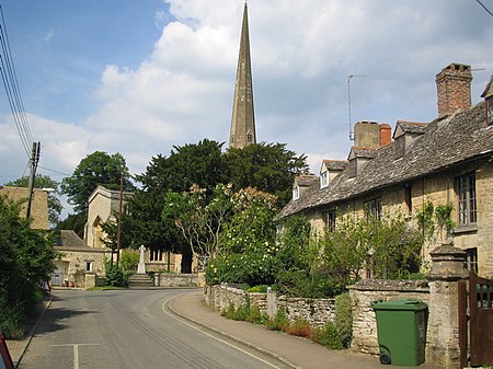
Kidlington is a large village and civil parish in Oxfordshire, England, between the River Cherwell and the Oxford Canal, 5 miles (8 km) north of Oxford and 7+1⁄2 miles (12.1 km) south-west of Bicester. It remains officially a village despite its size. The 2011 census put the parish population at 13,723.
Excerpt from the Wikipedia article Kidlington (License: CC BY-SA 3.0, Authors, Images).Kidlington
High Street, Cherwell District
Geographical coordinates (GPS) Address Website Nearby Places Show on map
Geographical coordinates (GPS)
| Latitude | Longitude |
|---|---|
| N 51.823055555556 ° | E -1.2902777777778 ° |
Address
Iceland
High Street 19-23
OX5 2DH Cherwell District
England, United Kingdom
Open on Google Maps


