place

Carnon River

Cornwall geography stubsEngland river stubsRivers of Cornwall
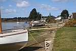
Carnon River near Point Mills geograph.org.uk 1234714

The Carnon River (Cornish: Avon Carnon) is a heavily polluted river in Cornwall, England, United Kingdom. It starts in Chacewater. Both Trewedna Water and River Kennall flow into the Carnon before it merges with Tallack's Creek to become Restronguet Creek, which eventually flows into the English Channel at the mouth of Carrick Roads.The Nebra sky disc, a gold-decorated bronze disc found in Germany and dated to the Bronze Age, contains both gold and tin from the Carnon valley. There was also an antler pick discovered, along with some other artefacts in 1790. In 2016, the pick was dated to be from the Early Bronze Age.In 1992, the river was hit by a major pollution incident, when over 45 million litres of contaminated water from the closed Wheal Jane mine was released by the collapse of an adit, colouring the river water red. A treatment works has since been installed at Wheal Jane to intercept the contaminated water and treat it to remove suspended metals and restore a neutral pH.

Excerpt from the Wikipedia article Carnon River (License: CC BY-SA 3.0, Authors, Images).

Carnon River
Old Tram Road,

Geographical coordinates (GPS) Address Nearby Places
placeShow on map

Wikipedia: Carnon RiverContinue reading on Wikipedia

Geographical coordinates (GPS)

Latitude Longitude
N 50.2078 ° E -5.083 °
placeShow on map

Address

Old Tram Road

Old Tram Road
TR3 6NL , Feock
England, United Kingdom
mapOpen on Google Maps

Carnon River near Point Mills geograph.org.uk 1234714
Share experience

Nearby Places

Chycoose
Chycoose

Chycoose (Cornish: Chy'n Coos, meaning house of the wood), Point and Penpol (Cornish: Pen Pol, meaning head of a creek) form a coastal settlement around Penpol Creek in Cornwall, England, United Kingdom. The creek is a ria, a tidal inlet on the north side of Restronguet Creek. It is situated approximately three-quarters of a mile (1 km) west of Feock village which is four miles (6.5 km) south of Truro.Chycoose is on the west bank of Penpol Creek and Penpol hamlet is at the north end of the creek. Point is on a small promontory where Penpol Creek joins Restronguet Creek. Trolver, a small coastal settlement, extends along the east side of the Penpol Creek south from Penpol. Today, all four settlements are residential in character with many of the houses having river frontages and all four are in the civil parish of Feock.However, until the beginning of the 20th century, Restronguet Creek was a busy commercial waterway with extensive wharves on the north bank. Penpol was a small port engaged in the export of tin and copper from the mining areas a few miles to the north and there were wharves at Point Quay served by an extension of the Redruth and Chasewater Railway; trains on this section of line were hauled by horses from Devoran, a mile (1.6 km) upstream. Restronguet Creek and Carrick Roads (the tidal estuary of the River Fal) are a popular centre for yachting and dinghy racing and the quay at Penpol is now used for leisure boating. 'The Restronguet Creek Society' is a voluntary organisation formed in 1972 to protect and preserve the creek and its environs.