Meden Vale

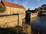
Meden Vale is a small former coal mining village originally known as Welbeck Colliery Village prior to renaming in the late 1960s.It is situated close to the small town of Market Warsop, in north Nottinghamshire, England, off the main A60 Mansfield to Worksop road, and lies within Mansfield District Council administrative area and Mansfield Parliamentary constituency, represented since 2017 by Ben Bradley of the Conservative Party. It is in the civil parish of Warsop. There is a small collection of shops, Post Office, a garage and the Three Lions public house. The River Meden flows through the village alongside the main road. The village has a rugby union side which plays in the RFU Midlands 5 East (North) division.
Excerpt from the Wikipedia article Meden Vale (License: CC BY-SA 3.0, Authors, Images).Meden Vale
Netherfield Lane,
Geographical coordinates (GPS) Address Nearby Places Show on map
Geographical coordinates (GPS)
| Latitude | Longitude |
|---|---|
| N 53.222 ° | E -1.126 ° |
Address
Netherfield Lane
Netherfield Lane
NG20 9PB , Warsop
England, United Kingdom
Open on Google Maps


