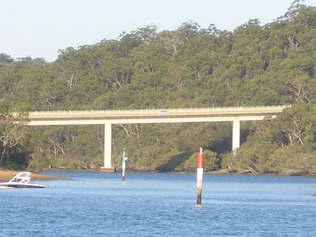
Alfords Point Bridge

Alfords Point Bridge is a twin 445-metre-long (1,460 ft) concrete and steel box girder road bridge that carries Alford Point Road as state route A6 across the lower Georges River between Padstow Heights in the City of Canterbury-Bankstown and Alfords Point in the Sutherland Shire in Sydney, New South Wales, Australia. The first bridge opened on 7 September 1973. Although the deck was built wide enough to accommodate three lanes of traffic, it carried one lane of traffic in each direction. In 1980 the lane arrangements on the bridge were changed to provide a third lane, and a tidal-flow traffic management system was introduced, with two lanes northbound in the morning and two lanes southbound in the evenings. When the first bridge was built, a second set of piles and abutments was built a few metres downstream, allowing for future duplication. The second bridge was opened for southbound traffic on 22 August 2008, leaving the first bridge for northbound use only.
Excerpt from the Wikipedia article Alfords Point Bridge (License: CC BY-SA 3.0, Authors, Images).Alfords Point Bridge
Alfords Point Road, Sydney Alfords Point
Geographical coordinates (GPS) Address External links Nearby Places Show on map
Geographical coordinates (GPS)
| Latitude | Longitude |
|---|---|
| N -33.9774 ° | E 151.0305 ° |
Address
Alfords Point Bridge
Alfords Point Road
2234 Sydney, Alfords Point
New South Wales, Australia
Open on Google Maps


