place

Schleptruper Egge

Hills of Lower SaxonyOsnabrück (district)Wiehen Hills
Funkturm schleptruper egge 01

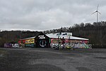
The Schleptruper Egge is a hill, 148 m high, in the Bramsche parish of Schleptrup and is part of the Wiehen Hills. To the north is the bog of Großes Moor at a height of about 47 m above sea level (NHN), the Mittelland Canal built in the 20th century and the Bramsche parish of Kalkriese. Immediately east of the Schleptruper Egge runs the A 1 motorway, the so-calle Hanseatic Line (Hansalinie). On the top of the Schleptruper Egge is the mast of the NDR Osnabrück-Engter Transmitter. The long distance path of Hünenweg, managed by the Weser-Ems Wiehen Hills Society (Wiehengebirgsverband Weser-Ems), which runs from Osnabrück to Papenburg, also leads over the Schleptruper Egge.

Excerpt from the Wikipedia article Schleptruper Egge (License: CC BY-SA 3.0, Authors, Images).

Schleptruper Egge
Zum Fernsehturm,

Geographical coordinates (GPS) Address Nearby Places
placeShow on map

Wikipedia: Schleptruper EggeContinue reading on Wikipedia

Geographical coordinates (GPS)

Latitude Longitude
N 52.374297 ° E 8.03117 °
placeShow on map

Address

Zum Fernsehturm 18
49565
Lower Saxony, Germany
mapOpen on Google Maps

Funkturm schleptruper egge 01
Share experience

Nearby Places

Pye (Osnabrück district)

Pye is a district of the city of Osnabrück, Germany. Its positioning in the countryside on the outskirts of Osnabrück and its good transport connections to the city make it an appealing area for residents. Until 1972 Pye was a separate village in the district of Osnabrück. It belonged to the parish of St. Johann (St. John) in Osnabrück and was a predominantly Catholic area. Agriculture formed the backbone of the local economy. On 1 July 1972 it became a district of Osnabrück; since 1978 it has had its own parish (St. Matthias). Pye is also the location of the Piesberg (derived from "Pyes Berg" (Pye's Mountain)). Coal mining took place here during the 19th and 20th centuries. Even today, stones continue to be mined from the Piesberg quarry. The Piesberg was also the location of the largest landfill site in the Osnabrück region until June 2006. The Museum Industriekultur (Museum of Industrial Culture) is situated on the Piesberg, giving insight into the history of mining on the mountain. In Pye there is a street called "Am Pyer Ding". This is in reference to the Old German term "Thing" - meaning that Pye was also the location of such a "Thing". The countryside surrounding Pye is mostly characterised by small to medium-sized woods, grassland and a branch canal, which is an offshoot of the Mittelland Canal. The Osnabrück-Piesberg railway station is located at the edge of the district - currently it is only used for special train journeys (using steam locomotives) on event days, travelling there from the central station in Osnabrück via the Osnabrück-Altstadt station.

Dodesheide
Dodesheide

Dodesheide is a town in the borough of Osnabrück, Germany; with a population of roughly 7,900 residents it is located to the north-east of the city. Its boundaries are delineated in the north by the Vehrter Landstraße, in the west by the landwehr – a former defensive line around the town consisting of a bank and ditches – in the south by the Sandbach and the Osnabrück-Bremen railway line; the city boundary itself marks its eastern border. It is made up of sections of the former districts of Schinkel and Haste. The district’s most significant building is the Haus Gartlage, a former Jesuit seat which some years ago was converted into residences. Apart from this and a number of farms, most of the developments in the Dodesheide district are from the 20th century. Since the 1950s, the construction of residential space following set construction stages has been systematically encouraged; one notable case is the “Dodeshaus” model building project from the 1960s, focused on the area between Haster Weg and Ellerstraße where primarily bungalows are situated. The eastern part of the district continues to be characterised by the barracks of the British army and the attached soldiers’ residences; their final withdrawal in 2009 led to expectations of extensive structural change in the area. There are two churches in Dodesheide: the Thomaskirche (Protestant) and the St. Franziskus Church (Catholic). At the beginning of the 1970s, the possibility of making Dodesheide the location of the planned University of Osnabrück was discussed; in the end, however, the district of Westerberg was chosen. Its main offices are located at the Schloss Osnabrück (Osnabrück Palace). A remnant of the planning from that time remains in the form of the Dodesheide student residence located on Mecklenburger Straße; with 206 residents it is today the second largest student residence in the town.The traditional perception of the name Dodesheide as linked to “Todesheide” (Death’s Heath) is most likely false. The name is assumed to derive from the Old German proper name “Dodo”: its proper meaning being “Dodos Heide” (Dodo’s Heath).