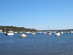
Bundeena, New South Wales

Bundeena is a village and suburb on the outskirts of southern Sydney, in the state of New South Wales, Australia. Bundeena is located 29 kilometres (18 miles) south of the Sydney central business district and is part of the local government area of the Sutherland Shire. Bundeena is adjacent to the village of Maianbar and lies on the southern side of Port Hacking, opposite the suburbs of Cronulla and Burraneer. The village is surrounded by the Royal National Park. The beaches at Bundeena are Jibbon Beach, Gunyah Beach, Horderns Beach and Bonnie Vale Beach. Cabbage Tree Creek and 'The Basin' separate Bundeena from the smaller village of Maianbar. A bush track and footbridge link the two villages. Bonnie Vale is also one of the few camp grounds within the Royal National Park.
Excerpt from the Wikipedia article Bundeena, New South Wales (License: CC BY-SA 3.0, Authors, Images).Bundeena, New South Wales
Bournemouth Street, Sydney Bundeena
Geographical coordinates (GPS) Address Nearby Places Show on map
Geographical coordinates (GPS)
| Latitude | Longitude |
|---|---|
| N -34.088061111111 ° | E 151.15406111111 ° |
Address
Bournemouth Street 61
2230 Sydney, Bundeena
New South Wales, Australia
Open on Google Maps


