place

Sinaloa Lake

Geography of Simi Valley, CaliforniaLakes of Ventura County, CaliforniaSimi Valley, California

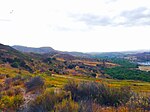
Sinaloa Lake is a 12-acre (4.9 ha) reservoir in southwestern Simi Valley. The lake is adjacent to the Sinaloa Golf Course and neighborhood. It has a 35-foot (11 m) deep earth dam which was constructed between 1925 and 1929. It has been owned by the Sinaloa Lake Owners Association since the early 1960s. The lake was drained in 1983 after heavy rains, but was rebuilt in 2000. Originally known as Robertson Lake, it is now named for Sinaloa, Mexico. Fish species include crappie, largemouth bass and others.The surrounding community of Sinaloa Lake is an unincorporated area of Ventura County, and voted not to be incorporated into the city of Simi Valley on September 27, 1966.Nearby Bard Lake is situated above Sinaloa Lake in an adjacent part of the same watershed.

Excerpt from the Wikipedia article Sinaloa Lake (License: CC BY-SA 3.0, Authors).

Sinaloa Lake
Madera Road, Simi Valley

Geographical coordinates (GPS) Address Phone number Website Nearby Places
placeShow on map

Wikipedia: Sinaloa LakeContinue reading on Wikipedia

Geographical coordinates (GPS)

Latitude Longitude
N 34.256 ° E -118.793 °
placeShow on map

Address

Sinaloa Golf Course

Madera Road 980
93065 Simi Valley
California, United States
mapOpen on Google Maps

Phone number

call+18055812662

Website
sinaloagolf.com

linkVisit website

Share experience

Nearby Places

Mount McCoy (Simi Valley)

Mount McCoy (previously known as Verde Hill) is a 1,325-foot-high peak in Simi Valley, California known for its characteristic 12 foot white cross on the top. There are numerous trails leading to Mount McCoy, which sits in a 200 acres (81 ha) nature area operated by the Rancho Simi Recreation and Park District (RSRPD), while the cross and its immediate surroundings are owned by the Simi Valley Historical Society. By 1813, the cross on Mt. McCoy was a landmark for the Friars and others in the Simi Valley.An 1858 map of the Simi Valley does show a cross on Mt. McCoy, but a newer cross was erected by Robert E. Harrington in 1921, and a concrete one later in 1941. Mount McCoy has been a landmark for the area since before the town was founded. In 1986, Mount McCoy was designated Ventura County Landmark No. 106. The main trailhead is located at 2 Washburn Street at the western end of Simi Valley. A trailhead to a shorter hiking trail is located around 56-58 Presidential Drive on the way to the Ronald Reagan Presidential Library. From the top of Mount McCoy there are views of the Simi Hills and Simi Valley, as well as Simi Peak, open-space areas and the Ronald Reagan Presidential Library. There are also views of the Santa Monica Mountains, Mount Baldy, the San Gabriel Mountains and the Topatopa Mountains, and on clear days, even the Ojai backcountry, the Channel Islands and the Pacific Ocean. It is one of two crosses overlooking the Simi Valley, the other one being situated by the Santa Susana Pass and Rocky Peak by the Santa Susana portion of eastern Simi Valley.

Challenger Park
Challenger Park

Challenger Park is a 141.55-acre open-space park (57.28 ha) located in southern portion of Simi Valley, California in the Simi Hills. The park is owned and maintained by the Rancho Simi Recreation and Park District. Challenger Park is used for mountain hiking, mountain biking, jogging, and horseback riding but with a focus on the preservation of wildlife habitat. The scenery lining the trails includes extensive oak woodlands, chaparral, and coastal sage scrub. The terrain varies greatly with rolling green hills and steep mountainous hills and canyons. The park offers miles of trails connecting to Long Canyon, Oak Canyon, Trough Canyon, Lone Oak Canyon, and other adjoining open-space nature areas in the southern section of the Simi Valley. There is a fairly easy hike to Thousand Oaks, CA via Long Canyon trails. To get to Oak Canyon, Old Windmill Park and Coyote Hills Park, you must cross Long Canyon Road. Fences run along the Long Canyon Road with dirt paths. There are also lights at the signals with push buttons for hikers, and raised buttons for equestrians. Adjacent to Challenger Park is also Bridle Trails, a private hiking area. There are scenic views of the City of Simi Valley from the park and it is a native habitat for numerous species of animals, including mule deer, mountain lions, coyotes, rattlesnakes, crawdads, California king-snakes, grey foxes, bobcats, as well as red-tailed hawks, barn owls, and numerous other raptors. From California State Route 118, take the First Street exit in Simi Valley and continue south, turn right if coming from the west and turn left if from the east. Follow this road for 2.8 miles and then turn left into the Challenger Park parking lot, just past the intersection with Stonebrook. From California State Route 23, take the Olsen Road exit in Thousand Oaks, CA and go northeast for nearly 2 miles to Wood Ranch Parkway. Turn right on Wood Ranch and go approximately two miles to the junction with Long Canyon Road. Then turn left onto Long Canyon Road and follow the road for 1.7 miles. Challenger Park will be on the right, shortly before Long Canyon Road becomes First Street in South Simi Valley. The address is 105 Challenger Park Road, Simi Valley, CA 93065.