Friedrichstadt (Berlin)
1691 establishments in the Holy Roman EmpireFriedrichshain-KreuzbergMittePopulated places established in 1691Zones of Berlin

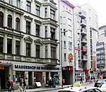
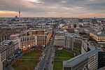
Friedrichstadt was an independent suburb of Berlin, and is now a historical neighbourhood of the city itself. The neighbourhood is named after the Prussian king Frederick I.
Excerpt from the Wikipedia article Friedrichstadt (Berlin) (License: CC BY-SA 3.0, Authors, Images).Friedrichstadt (Berlin)
Schützenstraße, Berlin Mitte
Geographical coordinates (GPS) Address Nearby Places Show on map
Geographical coordinates (GPS)
| Latitude | Longitude |
|---|---|
| N 52.508333333333 ° | E 13.391666666667 ° |
Address
Hotel Roter Adler
Schützenstraße
10117 Berlin, Mitte
Germany
Open on Google Maps


