Communauté de communes Le Grésivaudan
Commune communities in FranceIntercommunalities of IsèreIsère geography stubs
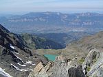
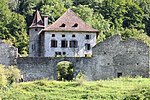
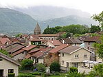
The Communauté de communes Le Grésivaudan is a communauté de communes in the Isère département and in the Auvergne-Rhône-Alpes région of France. It was formed on 1 January 2009 by the merger of several former communautés de communes. Its seat is in Crolles. Its area is 676.7 km2, and its population was 101,729 in 2018.
Excerpt from the Wikipedia article Communauté de communes Le Grésivaudan (License: CC BY-SA 3.0, Authors).Communauté de communes Le Grésivaudan
Chemin du Contour, Grenoble
Geographical coordinates (GPS) Address Nearby Places Show on map
Geographical coordinates (GPS)
| Latitude | Longitude |
|---|---|
| N 45.316666666667 ° | E 5.9666666666667 ° |
Address
Chemin du Contour
Chemin du Contour
38570 Grenoble
Auvergne-Rhône-Alpes, France
Open on Google Maps


