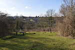
Downley is a village and civil parish in Buckinghamshire, England, which was included in Wycombe district before its abolition. It is high in the Chiltern Hills, overlooking the town of High Wycombe, although today it is almost indistinguishable from the urban spread of the latter town.
The central part of the parish is the common, this extends over about 56 acres (23 ha). It is part of the Chilterns Area of Outstanding Natural Beauty. Downley was originally within the 1890s civil parish of West Wycombe, however, in the 1930s West Wycombe village was incorporated into the Borough of High Wycombe and the remainder of the original civil West Wycombe Parish, which included Downley, became known as West Wycombe Rural Detached Parish. Due to Local Government reorganisation in the 1980s West Wycombe Rural Detached Parish was split into two civil Parishes, one of which was Downley Parish, the other being Piddington & Wheeler End. Downley was once three hamlets, Downley was the largest, with Littleworth and Plummer's Green on its south side. Both of these have now been incorporated into Downley as a whole, but there are still names such as Littleworth Road and Plomer Hill. Plomer is a derivative from Plummer.
Downley was extensively built up in the 1950s-1960s and is still changing now, with the parish boundary being extended.
The Memorial Hall, also known as the Village Hall, in the High Street was built in 1923 and is still in use. The old School, built in the 1870s is also still in use. There were also furniture making factories in the village as well as home workshops; a practice which was common in the Chilterns as High Wycombe and surrounding towns were large producers of furniture, in particular chairs from the Industrial Revolution onwards.
Downley was once home to several farms, the largest of these stopped working in the 1990s but can be plainly seen from commonside with its huge barns and unusual listed farm house.


