Lea, Wiltshire
EngvarB from August 2019OpenDomesdayVillages in Wiltshire

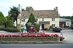
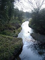
Lea is a village in Wiltshire, England, lying approximately 1.5 miles (2.4 km) east of Malmesbury. It is part of the civil parish of Lea and Cleverton which includes the village of Garsdon and the hamlet of Cleverton. Garsdon was a separate parish until 1934. The Charlton Stream forms the western boundary of the parish, and joins the River Avon near Cowbridge in the southwest of the parish. The Woodbridge Brook flows east–west across the parish to join the Charlton Stream northwest of Lea village. The southern boundary of the parish follows approximately the B4042 Swindon–Malmesbury road.
Excerpt from the Wikipedia article Lea, Wiltshire (License: CC BY-SA 3.0, Authors, Images).Lea, Wiltshire
The Street,
Geographical coordinates (GPS) Address Nearby Places Show on map
Geographical coordinates (GPS)
| Latitude | Longitude |
|---|---|
| N 51.578 ° | E -2.061 ° |
Address
The Street
SN16 9PA , Lea and Cleverton
England, United Kingdom
Open on Google Maps


