place

Goodmanham

Civil parishes in the East Riding of YorkshireOpenDomesdayUse British English from November 2014Villages in the East Riding of Yorkshire
Goodmanham
Goodmanham

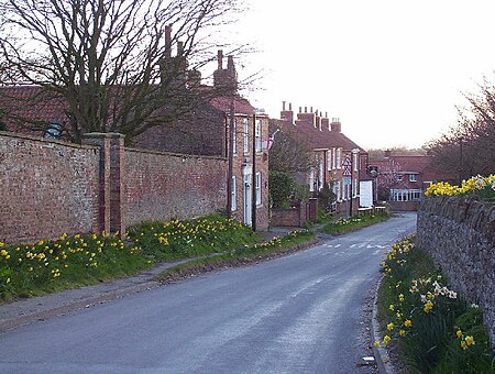
Goodmanham (historically Godmundingaham, the home of the people of Godmund mentioned in the year 627 in Bede's Historia ecclesiastica gentis Anglorum ) is a small village and civil parish in the East Riding of Yorkshire, England. It is situated approximately 2 miles (3 km) to the north-east of Market Weighton. The village is situated on the Yorkshire Wolds Way National Trail, a long-distance footpath. According to the 2011 UK Census, Goodmanham parish had a population of 244, an increase on the 2001 UK Census figure of 218.The village is built in a favourable position on a south-facing slope of the Yorkshire Wolds between two streams. It has a copious supply of water from numerous springs and naturally occurring limestone for building. The land is extraordinarily fertile in this region and people have lived here since prehistoric times.

Excerpt from the Wikipedia article Goodmanham (License: CC BY-SA 3.0, Authors, Images).

Goodmanham
Wateringdyke Lane,

Geographical coordinates (GPS) Address Nearby Places
placeShow on map

Wikipedia: GoodmanhamContinue reading on Wikipedia

Geographical coordinates (GPS)

Latitude Longitude
N 53.876802 ° E -0.648794 °
placeShow on map

Address

Wateringdyke Lane
YO43 3JB , Goodmanham
England, United Kingdom
mapOpen on Google Maps

Goodmanham
Goodmanham
Share experience

Nearby Places

Londesborough
Londesborough

Londesborough is a village and civil parish in the East Riding of Yorkshire, England. It is situated approximately 2.5 miles (4 km) north of the market town of Market Weighton. The civil parish is formed by the village of Londesborough and the hamlet of Middlethorpe. According to the 2011 UK census, Londesborough parish had a population of 182, a reduction of one on the 2001 UK census figure.The Yorkshire Wolds Way National Trail, a long distance footpath passes through the village. Some scholars suggest the still-undiscovered Roman camp of Delgovicia is in the vicinity of Londesborough. Londesborough Hall was a country house in the village but all that now remains is the park land that surrounded the house which is called Londesborough Park. The church dedicated to All Saints was designated a Grade I listed building in 1967 and is now recorded in the National Heritage List for England, maintained by Historic England. In 1823 Londesborough was a civil parish in the Holme Beacon Division in the Wapentake of Harthill. Londesborough is one of the sites in the East Riding that have been conjectured as the Romano-British town of Delgovicia, an eastern station associated with York. A Roman road from Brough on the Humber Estuary ran directly north to meet Londesborough estate and village, where were found Roman coins and burial repositories. The estate of Londesborough was one of the seats of the Dukes of Devonshire. It was an historical possession of the Clifford family—Earls of Cumberland—until the 5th Earl's only heiress married the Earl of Cork, from whose family the Dukes of Devonshire are descended. The estate's mansion in 1823 had recently been demolished. The 6th Duke of Devonshire was the patron of All Saints' Church, the ecclesiastical parish living, and a hospital for "six old bachelors or widowers, and six widows". Londesborough population in 1823 was 244. Within the parish was a blacksmith, a clerk, a schoolmaster who was also the parish clerk, the parish rector, the agent for the Duke of Devonshire, and the landlord of The Devonshire Arms public house who was also a maltster. Londesborough was served by Londesborough railway station on the York to Beverley Line between 1847 and 1965.