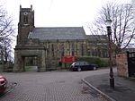
Burnage (ward)
Areas of ManchesterManchester City Council WardsUse British English from November 2021

Burnage is an area and electoral ward of Manchester, England. Different parts of this ward are represented by different MPs following boundary changes in 2018; the majority of the ward is part of the Manchester Withington constituency but a portion is part of the Manchester Gorton constituency. The 2011 Census recorded a population of 15,227.
Excerpt from the Wikipedia article Burnage (ward) (License: CC BY-SA 3.0, Authors, Images).Burnage (ward)
Green End Road, Manchester Burnage
Geographical coordinates (GPS) Address Nearby Places Show on map
Geographical coordinates (GPS)
| Latitude | Longitude |
|---|---|
| N 53.4271 ° | E -2.2067 ° |
Address
Green End Road
Green End Road
M19 1LE Manchester, Burnage
England, United Kingdom
Open on Google Maps


